

Forestiere Underground Gardens

Underground gardens
Our valley’s summer heat is intense and unrelenting. By the time that cool fall days finally arrive, they are welcome and refreshing.
With this year’s heat already here, it’s time to start thinking about ways to beat the heat. We’ve got a lot of choices in the air conditioning age – many more than our ancestors did.
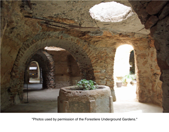
One of the best options to have survived the test of time is Fresno’s Underground Gardens. From 1906 to 1946, Sicilian immigrant Baldassare Forestiere carved a unique underground home beneath 10 acres of hardpan in northwest Fresno.
Forestiere’s subterranean habitation is one of the most intriguing and innovative structures in the state.
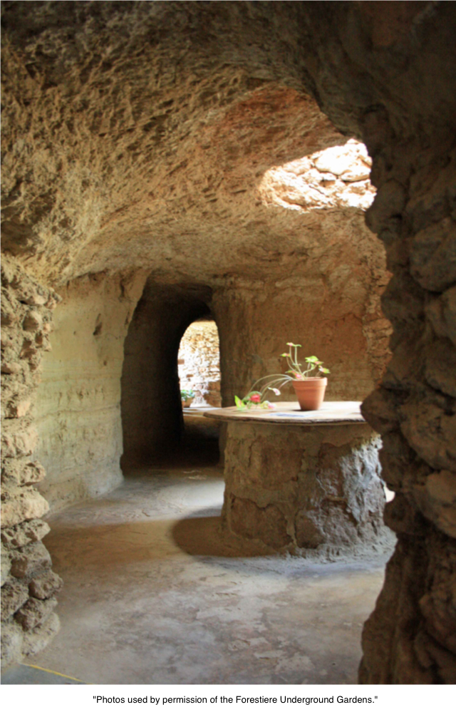
Photo by adam blauert
Italy
Although inspired by the ancient catacombs of Italy, Forestiere created something entirely new – an underground world full of life. He built large courtyards lit by skylights – windows to the aboveground world that also made it possible to grow a wide variety of trees and vines.
Rooms were constructed at three different levels with temperatures ranging from 10 to 30 degrees cooler than on the surface.
Baldassare was so pleased with his work that he kept building, eventually intending to open an underground resort. Remarkably, he did it all in his spare time with hand tools, a scraper, and two mules. Although his death in 1946 prevented the resort from becoming a reality, much of his remarkable underground world can be enjoyed by visitors today.
Located on Shaw Avenue, just east of Highway 99 in Fresno, the Underground Gardens are an easy trip from Merced County. Tours are offered March through November.
The tour schedule is as follows
March: Saturday and Sunday – tours at 10, 11, 12, 1, 2, and 3
April and May: Wednesday through Friday – tours at 11, 12, 1, 2, and 3; Saturday and Sunday – tours at 10, 11, 12, 1, 2, and 3
Memorial Day through Labor Day: Wednesday through Friday - tours at 10, 11, 12, 1, 2, 3, 4, including Memorial Day, Independence Day, and Labor Day
September and October: Wednesday through Friday – tours at 11, 12, 1, 2, and 3; Saturday and Sunday – tours at 10, 11, 12, 1, 2, and 3
November: Saturday and Sunday – tours at 10, 11, 12, 1, 2, and 3; Friday through Saturday of Thanksgiving weekend tours are offered at the same time to conclude the season.
Special sunset tours will be offered this May by reservation only.
Tours are about an hour long and wheelchairs up to 26 inches in width may be accommodated. Tours operate as long as it isn’t raining and the ground has had long enough to dry from any recent rainfall.

Photo by adam blauert
On a cool day, you may want a sweater or lightweight jacket. On an extremely hot day you may find that some of the rooms are warm, even if they are 10-30 degrees cooler than the outside temperatures.
Feel free to carry a bottle of water during your tour. You can also bring a camera and take photos for personal use, though rights to the photos remain with the Underground Gardens.
For more information
Website http://www.undergroundgardens.com/
Tickets
Adults: $15
5-17: $7
4 and under: free
Seniors 60 and older: $13
College students and active duty military: $12
The Forestiere Underground Gardens are one of the most unique, yet under appreciated architectural wonders of California. Forestiere was a self-taught genius who combined determination, hard work, innovative architecture and engineering, horticultural skill, and creative design with a spiritual symbolism that reflected his deep Catholic faith.
He was lucky to live in an age where red tape and complicated regulations had not yet made it nearly impossible for a determined and gifted person to experiment with innovative structures in his spare time. Yet many of the principles that he used in his underground world are being rediscovered as energy efficient and cost effective ways of keeping cool.
To find the Underground Gardens, exit Shaw Avenue and head east. Start looking for the sign immediately because the Gardens are only four blocks from the freeway on the south side of Shaw. You’ll have to find parking on the street which may require walking a bit on a busy day. From Shaw Avenue the Forestiere site doesn’t look like much. That’s okay, because what you’ve come to see is below the street level.
Creativity on display
No matter what you expect, the reality will probably still surprise you. In the midst of a city of lookalike tract homes and interminable shopping centers, the Forestiere Underground Gardens are a breath of fresh air. Not only are they visually interesting and a source of inspiration for creatively-minded visitors, the story of their construction is an inspiring tale of the results of hard work.
If Baldassare Forestiere could build a beautiful underground world with determination, two hands, two mules, a scraper, and 40 years, what can you do with all of the resources you have access to?
© Copyright 2013 Adam Blauert

San Luis Reservoir Area

O’Neill Forebay, Los Banos Creek Reservoir-Part of both the California Aqueduct and the Central Valley irrigation projects.

San Luis Reservoir
San Luis State Recreation Area
San Luis Reservoir, O’Neill Forebay, Los Banos Creek Reservoir: The San Luis San Luis Reservoir, O’Neill Forebay, Los Banos Creek Reservoir-Part of both the California Aqueduct and the Central Valley irrigation projects.
Three Units
State Recreation Area is made up of three units. San Luis Reservoir is the largest and is used primarily for fishing. Part of both the California Aqueduct and the Central Valley irrigation projects, it is the largest off-stream reservoir in the United States.
At full capacity, it measures nine by five miles at its widest points.

O'Neill Forebay
O'Neill Forebay
The O’Neill Forebay, a smaller lake below the San Luis Dam, is open to all kinds of recreation and offers the best fishing in the area.
Although this area can be windy, the O’Neill Forebay is more sheltered than the San Luis Reservoir. O’Neill Forebay is considered to be one of California’s premier fishing areas.
The State record striped bass was caught in O’Neill Forebay in 2008. It measured 52.5 inches and weighed 70.6 lbs.
Los Banos Creek Reservoir
Located a few miles to the south, receives much less visitation. It is best-known for springtime ranger-led hikes along the creek in the spring.
With a 5mph speed limit, Los Banos Creek Reservoir is Los Banos Creek primarily enjoyed by anglers.
A shoreline trail is provided for fishing access.

Los Banos Creek
Location
San Luis Reservoir and the O’Neill Forebay are located on Highway 152, a few miles west of I-5. Additional access is available from State Highway 33.
Los Banos Creek Reservoir is located on Canyon Road, southwest of Los Banos and I-5.
Distance from Merced
San Luis Reservoir and O’Neill Forebay: 48 miles
Los Banos Creek Reservoir: 42 miles
Distance from Los Banos:
San Luis Reservoir and O’Neill Forebay: 12 miles
Los Banos Creek Reservoir: 6 miles
Operating authority: California State Parks
Surface area of lake: San Luis Reservoir 12,700 acres
O’Neill Forebay 2,250 acres
Los Banos Creek Reservoir 623 acres
Facilities and activities
Boat ramp
Chemical/flush restrooms
Drinking fountains
Visitor center
Campgrounds/group campgrounds with BBQ grills/fire rings, shelters, hot showers
Picnic areas with tables, shelters, and BBQ grills
Group picnic areas and shelters
Swimming beach/area with showers
Dump station
Hiking trails (additional trails available in the adjacent Pacheco State Park)
Wildlife viewing areas
OHV recreation area (south side of Highway 152 at Jasper-Sears Road. Novice-level trails for both green and red sticker vehicles are provided)
Dogs allowed? Yes
Horses allowed? Yes, and many equestrian trails are available at the adjacent Pacheco State Park.
Hunting allowed? Yes
Fish species:
San Luis Reservoir and O’Neill Forebay: bass, bluegill, crappie, perch, shad
Los Banos Creek Reservoir: bass, bluegill, catfish, and crappie. Trout are stocked in the early spring, but don’t last through the summer because of water temperatures.
Boat rentals: No
For More information and special events
Website: http://www.parks.ca.gov/?page_id=558
O’Neill Forebay hosts a Kids Fishing Day in the spring. The popular Path of the Padres is a Ranger-led hike along Los Banos Creek that is offered from February through April.
Hikers enjoy a creekside walk through wildflowers and learn about the history, wildlife, and plant species of the area.
Nearby parks
Pacheco State Park is adjacent to San Luis Recreation Area and offers hiking and equestrian trails. Ranger-led wildflower hikes are offered in the spring.
The California Aqueduct Bikeway begins at San Luis Creek and goes 70 miles north to the Bethany Reservoir State Recreation Area with rest stops ten miles apart and chemical toilets
San Luis Reservoir, O’Neill Forebay, Los Banos Creek Reservoir-Part of both the California Aqueduct and the Central Valley irrigation projects.

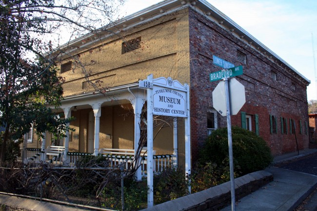
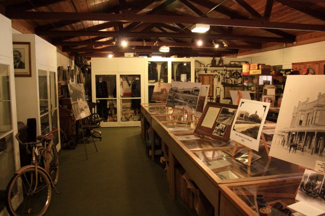
Tuolumne County Museum

Located in the Jail
The Tuolumne County Historical society operates one of the best museums in the southern Mother Lode region. Located in the old Tuolumne County Jail, the museum’s exhibits are spread throughout the thickly-walled brick cells and the former living quarters of the jailer’s family. Constructed in 1857 and rebuilt in 1866 after a prisoner set it on fire, the jail was used continuously until 1961.
Visitors today not only get a great museum experience, but also get to tour a historic jail. If you visit on a cold day, note that the glass in the windows of the cells is not original – when prisoners were housed in the building they had to live with the outside conditions – a far cry from incarcerations today!

Old Jail Cell Window
Excellent collection of history
The museum’s excellent collection of old photos and artifacts brings the past to life – mining, logging, railroads, ranching, and rural life. The exhibits are interpreted by clearly-written signs. Located in Sonora, the county seat of Tuolumne County, the museum displays not only Sonora’s history, but also that of other communities from the Tuolumne foothills to the top of the Sierra Nevada.
A detailed map located near the museum’s entrance identifies all of the current and former settlements in Tuolumne County.

Museum Exhibits
Historic guns
The historic gun collection is one of the best I’ve seen. Part of the display is a selection of ammunition in just about every caliber and gauge. If you’ve ever wondered how all the sizes compare, this is the place to find out.
For those interested in the history of the High Sierra, an exhibit focuses on the history of nearby Sonora Pass (today’s Highway 108) and the pioneers who developed it as a trans-Sierra crossing.
The museum is located at 158 West Bradford Avenue, two blocks from the city center. Directional signs on Highway 49 make it easy to find.
The hours are 10-4 Monday through Friday and 10-3:30 on Saturdays. Helpful volunteers are available to answer questions and show visitors around.

Museum Exterior 1
Enjoyable reading
The TCHS has published a number of excellent books of local history. On my recent visit I picked up copies of Sonora Pass Pioneers and When Steam Was King, both of which increased my knowledge about the development of Sonora Pass and railroads in the Sierra foothills. They’ve also given me many hours of enjoyable reading. Special events including frequent presentations by local historians and an annual Lamplight Dinner fundraiser are also offered.
In addition to the exhibits, an extensive research library is available for family historians and anyone interested in digging more deeply into the county’s history. The research library is open on Tuesdays from 9AM to noon. A donation is requested to help cover the cost of maintaining the collection and the facility.
Just over an hour’s drive from most locations in Merced County, the museum is an easy day trip and can be combined with a visit to Sonora’s downtown, the Moccasin Hatchery, Jamestown, Columbia State Historic Park, Railtown 1897 State Historic Park, or any of the caverns in nearby Calaveras County.
For more information about the museum or the research library,
please to: http://tchistory.org/index.html or call (209) 532-1317.

Fishing and Floating the Merced River
The Merced is our local river and it can be a great place to fish or float. Because access points aren’t well publicized, this page is an attempt to provide some information about them.
Starting in the high country of Yosemite National Park, the river flows westward for 145 miles before joining the San Joaquin near the town of Newman. The following is a list of access points in Merced County starting at the western end of the river and working east towards Mariposa County.
Safety:
Fishing is generally a safe river recreation as long as you do not wade out into the river.Swimming, boating, and floating the river on rafts or tubes are more hazardous activities.They are not recommended except in designated swimming sites such as the Hatfield and McConnell State Recreation Areas.Do not venture out into the river unless you are a strong swimmer, you wear a life jacket, you are sober, and you have a first aid kit and plenty of emergency supplies.
If you’ve never floated a river before, find someone experienced to go with.
The river has several rapids and places where rafters and boaters may be swept into trees and vines.There are also places where the river splits into multiple channels and it can be difficult to choose the safest route.High water flow, especially in the spring and after storms, may make the river extremely dangerous.Mid to late summer is usually the safest time to go, but this is not always the case.
Rivers have dangerous underwater hazards that can snare and drown swimmers and boaters.Every year California’s rivers claim lives!Think carefully before getting in the river and observe any posted safety warnings.
Some of the best online information about floating the river can be found at:https://www.americanwhitewater.org/content/River/detail/id/5042/.
Access Points:
George J. Hatfield State Recreation Area: Located near the river’s confluence with the San Joaquin, this state park offers the last access point to the river.Camping, picnicking, fishing, wading, and swimming are all permitted.Located at 4394 North Kelly Road which is technically in the town of Hilmar, the closest population center and supplies is actually Newman.

Photo by Adam Blauert
For more information go to http://www.parks.ca.gov/?page_id=556.
A brochure that covers both Hatfield and McConnell State Recreation Areas can be downloaded at:
http://www.parks.ca.gov/pages/554/files/McConnellHatfield.pdf
You can also call the park office at (209) 826-1197 for more information.
Hagaman Park/Highway 165:
The signs posted by Merced County at Hagaman Park tell visitors that they should stay out of the river, but the brochure produced by California State Parks to provide information about its two parks along the river (Hatfield and McConnell) lists it as one of the places you can take your raft or canoe out of the river if you are floating it.
The result is confusion.I don’t recommend Hagaman Park as a place to access the river, but if you are interested in doing so, contact Merced County Parks and Recreation first: (209) 385-7426.

Photo by Adam Blauert
You can also find park information at http://www.co.merced.ca.us/index.aspx?NID=1410.
Hagaman Park is located at the intersection of Highway 165 (Lander Avenue) and River Road.Highway 165 crosses the river and all potential access points near the highway are marked “No Trespassing.”
McConnell State Recreation Area:
This state park offers camping, picnicking, and some of the best access for fishing, wading, and swimming on the lower river.Located off El Capitan Way at the end of McConnell Road, the closest population centers and supplies are Delhi and Livingston.
For more information, go to http://www.parks.ca.gov/?page_id=554.
A brochure that covers both McConnell and Hatfield State Recreation Areas can be downloaded at:
http://www.parks.ca.gov/pages/554/files/McConnellHatfield.pdf
You can also call the park office at (209) 394-7755 for more information.
Bridges:
Highway 99 Bridge:All potential access points along the highway are marked “No Trespassing.”
Santa Fe Avenue Bridge: Like Highway 99, all potential access points along the highway are marked “No Trespassing.”
Oakdale Road Bridge:There’s plenty of parking near the bridge and you can walk across the original 1912 bridge (now only open to foot and bike traffic), but the potential river access points are signed “No Trespassing.”It’s clear that some people do access the river here, but you’re liable to citation for trespassing if you do.
Highway 59 Bridge: Although official signs at this location delineate the fishing regulations for this part of the river, the landowner has informed me that any access at this point will be considered trespassing. Don’t access the river at this location."
Snelling Road Bridge:Like the Highway 59 Bridge, land on both sides is private, but access has been allowed from the corridor along the highway.If you access the river here, be aware of all posted signs which may limit access in the future.The bridge is located on Snelling Road, 0.7 miles south of the junction with Highway 59.
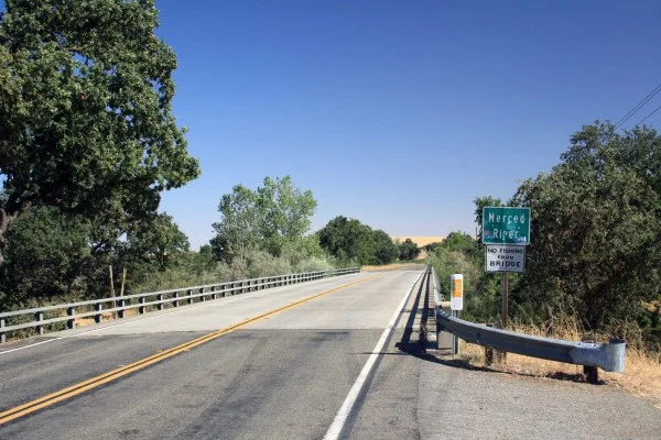
Photo by Adam Blauert
Snelling:
I’ve talked to a lot of people who have fished the river at the end of 3rd Street in Snelling, but there are currently “No Trespassing” signs posted.If you visit, check the signs before you access the river.
This area is accessed by turning south on 3rd Street (near the Chevron gas station) and following the road for a short distance.It becomes a rough dirt road near the river.

Photo by Adam Blauert
Henderson Park:
This county park is located 1 mile east of downtown Snelling on Merced Falls Road.It offers picnic areas, playgrounds, and plenty of river access.Signs warn visitors about the dangers of river access, but do not prohibit it.

Photo by Adam Blauert
For more information go to http://www.co.merced.ca.us/index.aspx?NID=1454
or call (209) 385-7426. This is one of the most picturesque spots on the lower river. A $3/car entry fee is charged on weekends and holidays.
Other access points
First access point east of Snelling: Set your odometer to zero at the intersection of 3rd Street and Highway 59 in Snelling. Highway 59 becomes Merced Falls Road at the junction with County Highway J59. The second access point to the river is 1.6 miles beyond 3rd Street and Highway 59. After you pass the J59 junction and Henderson Park, look for the first yellow sign indicating a left curve. There is a small parking area and a sign indicating fishing regulations on the right side of the road.
MID Cuneo Access:Located at mile 2.5, you will see a sign, a fenced gravel parking lot, and a restroom. The river is a short walk from the parking area along a trail.This access point may be closed seasonally, even when fishing is allowed.
Access between Cuneo and Crocker Huffman:At mile 3.3 begins a series of parking areas along the bank of the river to mile 3.6. The first one is located by an electrical pole and mailboxes for 5706 and 5996 Merced Falls Road. The parking areas end across from a sign indicating the entrance to 5996 on the left side of the road.These areas have been “No Stopping Any Time,” since Summer 2014 due to litter and traffic problems.According to Merced County, you can stop briefly to drop off fishing gear or rafts, but then must move your vehicle beyond the signs.
MID is currently constructing a new parking and access area that should be opening just east of this access point.The estimated opening date is sometime later in 2015.
MID Crocker-Huffman Fishing Access:After a 40 mph curve, you’ll see a fenced gravel parking lot and a sign indicating MID ownership at mile 4.1. If you pass A-1 Bait and Tackle, you’ve driven too far. A hike of about ¼ mile from the parking area will take you to the dam. Note that fishing regulations are different for the area above the dam and the area below. Consult the DFG’s fishing regulations to make sure that you are in compliance.This access point may be closed seasonally, even when fishing is allowed.
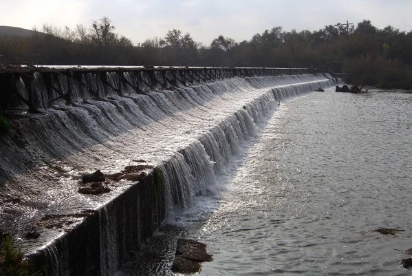
Photo by Adam Blauert
PG&E River’s Edge Fishing Access:This access point is 6.2 miles beyond Snelling, next to the PG&E hydroelectric plant. This access point allows you to fish above the spillway of the Merced Falls Dam. Note that swimming, float tubes, and boats are not allowed because of the proximity to the dam.
Hornitos Road Bridge Area:After Merced Falls Road turns sharply north, make a right turn on Hornitos Road. Turn again when the road splits for Lakes McSwain and McClure (left) and Hornitos Road (right). There are a number of places to park near the bridge. This area is 6.4 miles from 3rd and Highway 59 in Snelling. This is a popular place to fish from the shore or to launch float tubes or canoes.

Photo by Adam Blauert
PG&E Lake McClure Road Access:7.2 miles east of Snelling on Lake McClure Road, a right hand turn just before you reach the entrance gate to Lake McSwain and Lake McClure Recreation Area leads to another PG&E access point directly below the Lake McSwain Dam.

Photo by Adam Blauert
Mariposa County Access:
Beyond the McClure Road access point, the river is a part of Lakes McSwain and McClure. It becomes a free-flowing river again at the eastern end of Lake McClure where it is crossed by the Highway 49 Bridge.There is no road along the next 8.4 miles of the river.A very rough trail follows it (washed out on the Highway 49 side) but you can follow it cross-country on the northern side of the river until it becomes a true trail again.The eastern side of the trail is accessed from the end of the Briceburg Road.
There is no bridge across the confluence of the North Fork of the Merced, which can only be waded safely in low water conditions.The Briceburg Road follows the next 5 miles of the river beyond the trail up to where it joins Highway 140.From that point onwards, Highway 140 parallels the river closely into Yosemite National Park.
There are many views of the river from the road and many places to fish.Floating the river above Lake McClure is not recommended as there are many dangerous class III-IV rapids and a small waterfall near the confluence of the North Fork.
Rafting services
Several whitewater rafting companies offer guided trips to this area:
ARTA:Merced/Tuolumne - http://www.arta.org// (209) 962-7873
All-Outdoors California Whitewater:Merced/Tuolumne/Stanislaus/Cherry Creek - http://www.aorafting.com// (800) 247-2387
O.A.R.S.:Merced/Stanislaus/Tuolumne - http://www.oars.com/california/ (800) 346-6277
Whitewater Voyages:Merced/Tuolumne - http://www.whitewatervoyages.com/(800) 400-7238
Zephyr Whitewater:Merced/Tuolumne - http://www.zrafting.com/
From the end of the road in Yosemite, trails follow the river past Vernal and Nevada Falls to its sources in the wilderness of the park.
Avoiding Trespassing:The safest spots for legal river access in Merced County are Hatfield, McConnell, Henderson, and the access points maintained by MID and PG&E. The others are privately owned, but have not been posted or fenced in the past (this is always subject to change). This seems to indicate that the landowner is allowing access, however you may risk trespassing if you access the river at these points.
Taking Care of the River: Unfortunately, several of these access points have been trashed by previous users. Despite the work of volunteers to clean up the garbage, the problem continues. If the situation doesn’t improve, more access points may close or be posted “No Trespassing.”
Make sure you pack out your garbage and do anything you can to help keep these areas clean.

Photo by Adam Blauert
Fishing Regulations:Make sure you check fishing regulations for the area in which you plan to fish:http://www.dfg.ca.gov/. They change at the Crocker Huffman Dam.Although they are usually posted at the areas between the dam and the Highway 59 Bridge, conditions are always subject to change and may not be posted.
Other fishing and boating resources:
Fishing and Boating Resources at http://www.takemefishing.org/
Department of Fish and Wildlife Regulations: https://www.wildlife.ca.gov/
Department of Boating and Waterways Regulations: http://www.dbw.ca.gov/
Reservations for State, Federal, and Army Corps of Engineers Campgrounds: http://www.reserveamerica.com
The goal of this page is to provide useful and accurate information about river access. If you find something that is inaccurate or discover that conditions have changed, please inform the author atadamblauert@yahoo.com

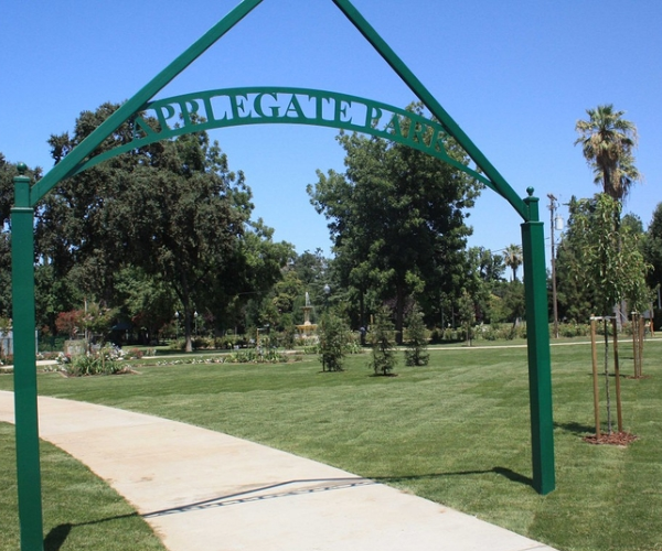
Merced's Central Park: Applegate Park, Zoo & Kiddieland Merced

flag in park
Applegate Park is Merced’s central park
Located along the Bear Creek Bikeway, the park is an excellent destination on bike or foot. It offers 32 acres of recreation with a zoo, outdoor theater, picnic tables, bbq grills, volleyball nets, tennis/basketball courts, a skate park, rental facilities, a large playground, a rose garden and fountain, and the Kiwanas-sponsored Kiddieland amusement park.
train
Plenty of parking is located around the park. Many community events are held at Applegate, including concerts and plays in the summer.

fountain
Location
Applegate Park is located along Bear Creek and the Bear Creek bikeway, between M and R Streets. The southern edge of the park follows 25th Street, P Street, and 26th Street.
Parking is available along the southern edge, N Street, and a parking lot on R Street near the Zoo.
applegate
Applegate Park Zoo
Merced Open Air Theater
Sports Facilities (Tennis, Basketball, Volleyball)
Skatepark
Playground
Fitness Equipment
Rental Facilities
playground

zoo 1
Applegate Park Zoo
The zoo specializes in local wildlife and activities for children, showcasing species native to the Central Valley and the foothills. From commonly-seen birds such as egrets and hawks to the elusive mountain lion, the zoo offers a cross-section of native wildlife.
Most of the animals have been relocated from wildlife rescue agencies.
Although owned by the City of Merced, the zoo is operated by the nonprofit Merced Zoological Society.

zoo 2
Friendly, trained volunteers are available to answer questions. This is a great place to get a close-up view of local species before heading out to a nearby wildlife refuge.

zoo 3
Hours and Admission
The zoo is open from 10-5 daily in the spring and summer and from 10-4 in the fall and winter, weather permitting. The zoo is closed on Thanksgiving, Christmas, and New Year’s Day.
For the latest Zoo hours and cost for admission, click here
Location
The zoo is located on R Street between Bear Creek and 25th Street. A parking lot is located on the corner of R and 25th.

goats
Activities
Petting Zoo and Goat Feeding: Friendly (and hungry) goats can be fed with goat food for sale at the zoo’s gift shop until the day’s supply runs out. Visitors who wish to feed the goats are advised to visit before 2PM.
The zoo also offers a small petting area where kids can play with chickens, rabbits, ducks, kittens, turtles and guinea pigs.
Field Trips: The Merced Zoological Society can arrange guided visits to the zoo for school groups.
Zoo Camp and Special Events: The zoo holds two one-week zoo camps for children aged 6 to 9 and a “Trick or Treat in the Zoo” on Halloween.
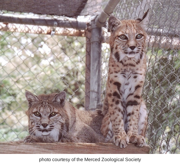
bobcats
Sometimes it is the "small animals" that are fun for the little ones!
This is a safe and fun option for families with small children. A storytime for kids aged 3-5 is offered every Saturday from 11-12. A number of other special events happen throughout the year.

savana
Birthday Parties
The zoo can be rented for birthday parties. Facilities include the Rossotti Ed-Zoo-Cation Center building with tables, chairs, refrigerator, freezer, and silverware. Table coverings, napkins, plates, cups, and invitations in an animal theme design are provided.
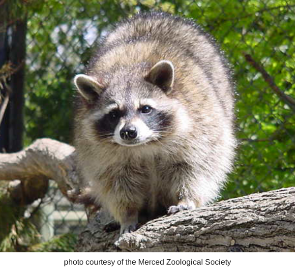
racoon
Zoo Parent Adoption Program
Groups can participate in the Zoo Parent Adoption Program which allows them to help feed and care for the zoo’s animals.
Gift Shop
The Zoological Society operates a gift shop that specializes in educational toys, books, and gifts. All proceeds help support the zoo’s operations.
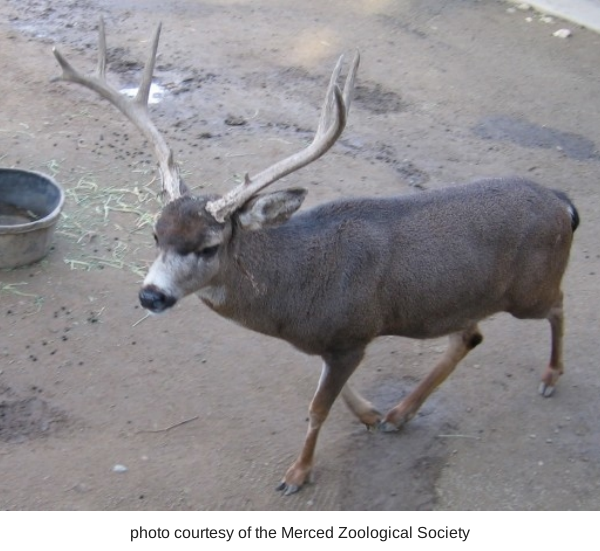
buck
Species
Mammals: black bear, mule deer, bobcat, raccoon, red fox, silver fox, opossum, goat, capuchin monkey
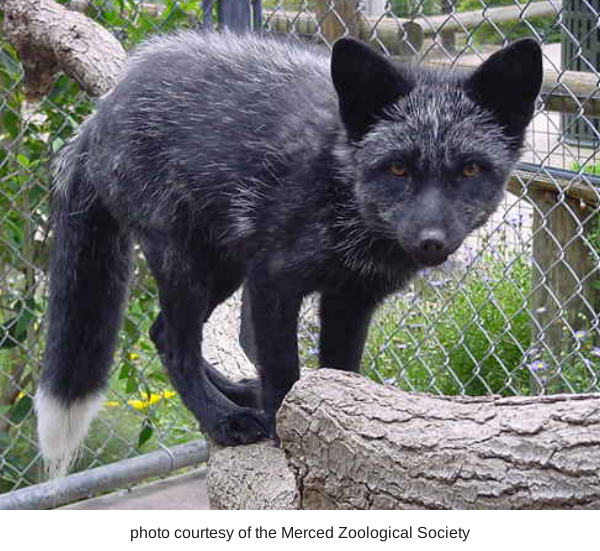
fox

screach owl
Birds: albino scrub jay, black crowned night heron, black swan, burrowing owl, cattle egret, emu, great egret, great snowy egret, green heron, great horned owl, harrier hawk,

owl
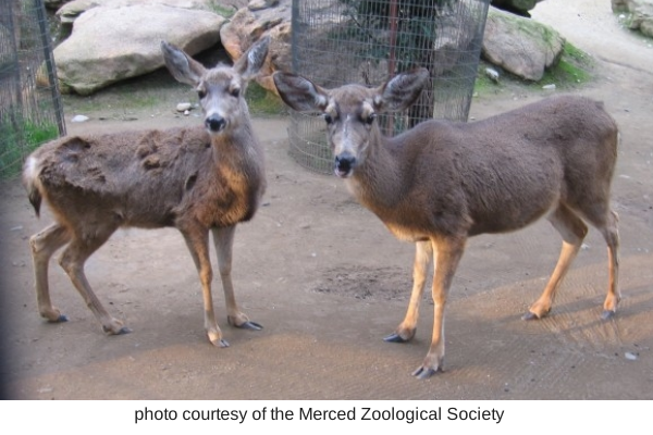
deer
ibis, kestrel, killdeer, magpie, northern flicker, peacock, raven, red tailed hawk, snowy egret, screech owl, Swainsons hawk, wild turkey, whistling (tundra) swan, wimberl, white faced ibis
Reptiles: tortoise, turtle
City of Merced- Applegate Zoo info (click here)
or contact the Merced Zoological Society at Mercedzoological@sbcglobal.net /
(209) 725-DEER (725-3337)
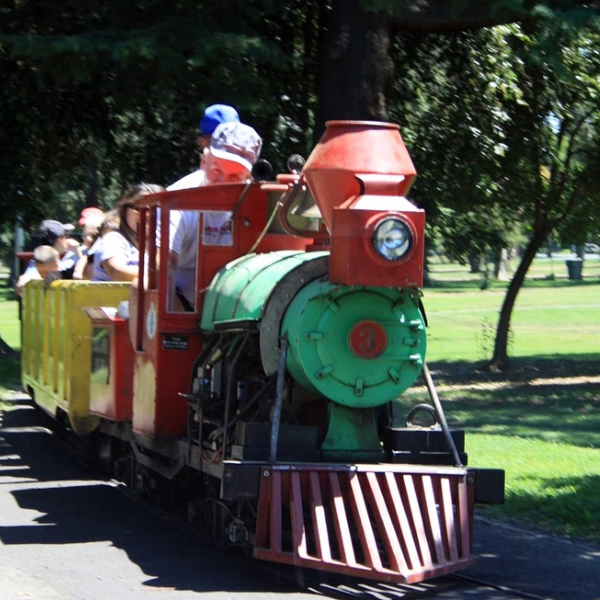
Kiddieland: Merced Kiwanis
Oporates the local Kiddieland amusement park since 1957. With six rides including a train that loops around Applegate Park, Kiddieland is a great place to take children on weekend afternoons.
Friendly Kiwanis volunteers operate the rides on Saturdays and Sundays from 1-5PM starting in March of each year.

Kiddieland 1
The amusement park remains open through October. Snacks are available at a refreshment booth. Kiddieland can be also be rented for private parties.
For more information about Kiddieland, click here
Location: Near the intersection of 25th and Q Streets.

Kiddieland 2
Additional information: Check out the Kiwanis webpage at http://greatermercedkiwanis.org/kiddieland Kiwanis is a worldwide volunteer organization whose motto is “serving the children of the world.”
Merced Open Air Theater
The most popular outdoor entertainment venue in Merced County, the Open Air Theater is the site of free concerts and plays throughout the summer. The theater can be rented for private events. Visit the City of Merced’s webpage for rental information: City of Merced Rental information.

Open Air Theater
Merced Shakespearefest stages Shakespeare plays at the Open Air Theater every summer. For more information go to: http://www.mercedshakespearefest.org/index.htm
Location: The theater is located in the middle of the park along the bikeway.
Sports Facilities
Volleyball nets are located in the eastern half of the park, between M and O Streets.
Tennis and basketball courts are located in the center of the park, near Kiddieland.
Skatepark: The skatepark is located in the center of the park, near O and 26th Streets.

Skatepark
Bikeway: Applegate Park is located along the Bear Creek Bikeway, which runs from McKee Road to Highway 59.
This route connects with other bikeways and bike lanes in Merced.
For a map, go to http://www.cityofmerced.org/documents/bikepathmap.pdf
Also check out our page titled Bike Paths in Merced County for additional bike routes throughout the county.
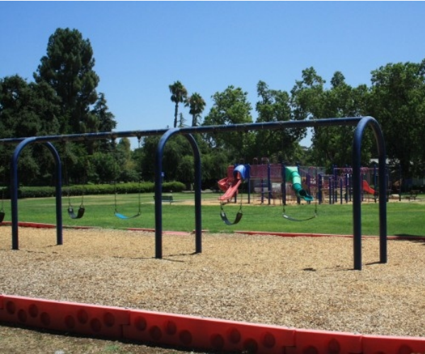
Playground: A large playground is located in the center of the park along 25th street between Q and P Streets. The playground includes swings, a large climbing structure with slides, and benches.
Rental Facilities: The Rossotti Ed-Zoo-Cation Center, Merced Open Air Theater, Scout Hut, Picnic Shelters, Gazebo and Rose Garden can all be rented for group events.
Visit the City of Merced’s webpage for rental costs and forms: City of Merced Rental information.

Madera County Museum
Madera County Museum
It’s a great time to visit the Madera County Museum---unless it is very hot!
Why now and not during the summer? Well, the museum has many things – including one of the best collections of history in the Central Valley – but the one thing it doesn’t have is air conditioning. In fact, it’s often closed in the summer because of the heat.

Photo By Adam Blauert
Don’t let that be a deterrent
I was blown away by the museum’s extensive collection and the successful way in which it brings to life the history of our valley. It’s a “new favorite” on my list of local places.
Although not air conditioned, it is heated, so you can visit in comfort throughout the cooler months. If you plan to visit around the holidays, call and make sure the museum will be open. The museum holds special events throughout the year and is specially decorated for Christmas.
Like the Merced County Historical Society Museum, it is located in county’s old courthouse. You can find it at 210 W. Yosemite Avenue – only about 30 miles south of Merced.
The main floor is divided up into rooms based on important themes in Madera County history. Although there are some differences between its history and Merced County’s history, there are also many similarities.
The major exhibits include Native Americans, pioneers, agriculture and ranching, logging, early photography, a reproduction of a turn-of-the-century general store, and the involvement of Madera County citizens in America’s wars.
Every possible display space has been used to showcase a truly amazing collection of artifacts – including many things I haven’t seen in any other museum.
Some of my favorites include a full-size reproduction of a logging flume, an excellent collection of Native American basketry, an altar cloth from the temple in Madera’s Chinatown, and an example of a “duster” worn by stagecoach passengers to protect clothing from dusty roads.

Photo By Adam Blauert
Several rooms on the second floor recreate a turn-of-the-century home. The original courtroom remains much as it was when the building was constructed. One of the largest rooms contains representations of Madera storefronts and window displays of the past century.
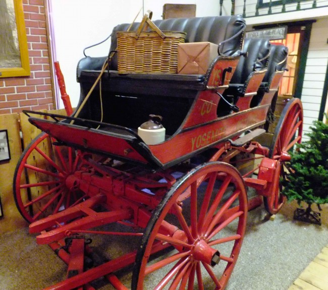
A restored stagecoach
Once used on the road from Madera County to Yosemite National Park, is one of the highlights.
By the time we’d seen the second floor, I was already more than impressed and ready to write a glowing review about it on this website.
Then we headed down to the basement. The sign at the top had led me to expect a room or two of tools and machinery.

Photo By Adam Blauert
Instead I found that the entire basement was also crammed with exhibits including a meticulously recreated blacksmith shop, a miner’s cabin and mining relics, a display about the granite quarry at Knowles, and an extensive collection of antique household and office technology.

Photo By Adam Blauert
Throughout the museum history is brought to life by a well-chosen collection of historic photos. Allow at least an hour and a half… better yet, plan for two hours or more. We stayed until closing time and could have stayed longer.
Hours
The museum is only open from 1 to 4PM on Saturdays and Sundays.
For more information you can call (559) 673-0291.
Stanislaus National Forest

Stanislaus National Forest
Merced County is adjacent to two national forests. Flowing westward through the county, the Merced River forms the dividing line between Stanislaus National Forest and Sierra National Forest. Directly in the middle of the two forests is Yosemite National Park, the ultimate source of the river.
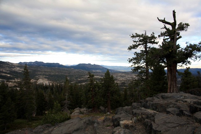
With the Merced River as a southern boundary, Yosemite National Park and the crest of the Sierra as an eastern boundary, the Calaveras/Amador County line as a northern boundary, and a rather erratic line through the foothills and lower pines as a western boundary, Stanislaus National Forest offers 898,099 acres for a wide variety of recreational activities.
It is a land that stretches from dense forests of tall pines and firs to sharp granite peaks; a land of meadows, lakes, rivers, wildlife, and wildflowers. In the winter, heavy snow transforms it into a great place for skiing, snowboarding, snowshoeing, snowmobiling, playing in the snow, and enjoying beauty and solitude.
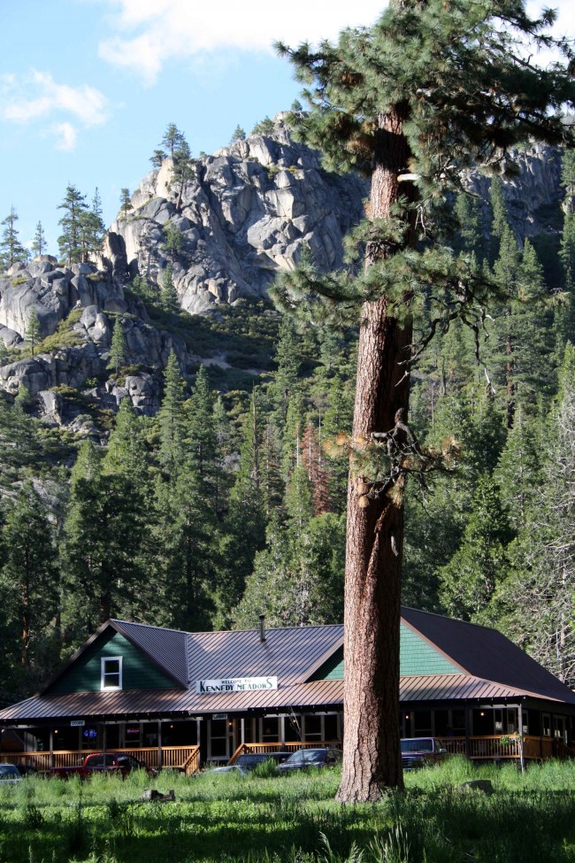
Photo by adam blauert Kennedy Meadows
Because the area is so diverse and offers so many recreational opportunities, there is often no clear answer to the question “What do you do there?” This article is an effort to answer that question and to provide a list of useful resources for learning about the forest and its recreational opportunities.
One of the best resources to start with is the annual visitor guide produced by Stanislaus National Forest is
Popular recreational activities within Stanislaus National Forest include
Auto touring
Visiting historic towns
Hiking and backpacking in wilderness areas
Hiking trails outside of wilderness areas
Camping
Ranger-led activities
Fishing
Boating
Swimming
Hiking and camping with dogs
Horseback riding
Mountain biking
OHV riding and exploring 4-wheel drive roads
Hunting
Downhill skiing
Playing in the snow
Cross-country skiing and snowshoeing
Snowmobiling

Stanislaus River photo by adam blauert
Within the forest there are many privately owned areas. Some of these offer additional recreational opportunities plus tent and RV campgrounds, lodging, restaurants, stores, and gas stations.
Ranger Stations
The Stanislaus National Forest Headquarters is located at 19777 Greenley Road in Sonora.
You can get general forest information and recreation permits by contacting the headquarters. The phone number is (209) 532-3671 and the general website for the entire forest is www.fs.usda.gov/stanislaus/.
The forest is divided into four districts which can provide more specific information about their respective areas:
Groveland District: 24545 Highway 120, Groveland – (209) 962-7825
Mi-Wok District: 24695 Highway 108, Mi-Wuk Village - (209) 586-3234
Summit District: #1 Pinecrest Lake Road, Pinecrest – (209) 965-3434
Calaveras District: 5519 Highway 4, Hathaway Pines – (209) 795-1381

Highway 108
Road Access and Auto Touring
Stanislaus National Forest is crossed west to east by Highways 120, 108, and 4. Anumber of secondary roads ranging from two-lane paved roads to rough four-wheel drive roads crisscross the forest. The major highways are worth driving simply to enjoy the views.
Major Towns, Supplies, Lodging, Food, and Gas
The major supply and service locations are adjacent to the major roads. Most of these towns have historic roots dating back to the 1800’s and are worth a visit in their own right. Especially historic and charming are Groveland, Jamestown, Sonora, Columbia, Twain Harte, Angels Camp, and Murphys.
Each of the major routes has chambers of commerce and/or business associations with websites for information about lodging, food, supplies, gas, local activities, and special events. I’ve listed them below in order from south to north:
Highway 120 ~ Big Oak Flat, Groveland, Buck Meadows, Mather
Highways 108 and 49 ~ Jamestown, Sonora, Columbia, Twain Harte, Mi-Wuk Village, Long Barn, Pinecrest, Strawberry, Dardanelle, Kennedy Meadows
Highway 4 photo by adam blauert
Highway 4 ~ Angels Camp, Murphys, Arnold, Bear Valley
www.ebbettspassadventures.com/
Wilderness Areas
Three wilderness areas are within or partly within the boundaries of Stanislaus National Forest. They offer some of California’s best hiking, backpacking, and fishing.
They are also great places to enjoy abundant and brilliant wildflowers and to see a variety of wildlife in its natural habitat.

Emigrant Wilderness Pack Trip photo by adam blauert
Emigrant Wilderness
The most popular wilderness area within the forest, the Emigrant Wilderness is adjacent to the northwest boundary of Yosemite National Park. Much of its popularity is the result of the terrain being somewhat less challenging than the steeper southern Sierra Nevada.
A land of low granite ridges with beautiful meadows and lakes, it is much like the northwestern part of the Yosemite Wilderness.

Columns of the Giants photo by adam blauert
Many remnants of volcanic activity can be seen, especially in the northeastern section. Although there are plenty of easier trails, you can also find many challenging routes that will take you far from any road.
The wilderness has a long human history and many of the lakes have been enlarged by small “check dams” that ensure a lasting water supply for grazing cattle through the summer.
Many of the meadows have been used as summer pasture since the 1800’s. Cattle are still often seen and remain a part of the living history of the area.
The lakes and streams provide some of the best fishing in the northern Sierra Nevada. There are several short backpacking and hiking destinations accessible from the western edge of the wilderness, but some of the most impressive destinations require trips of four days or more.
For more information go to: www.fs.usda.gov/recarea/stanislaus/recreation/recarea/?recid=15107
Carson-Iceberg Wilderness
Named for explorer Kit Carson who pioneered a trail through the area and for the Iceberg, a granite landmark located near the southern boundary of the wilderness, the western part is managed by Stanislaus National Forest and the eastern part by Humboldt-Toiyabe National Forest.
The Pacific Crest Trail traverses the eastern section. The terrain is rugged and steep, with fewer lakes than the Emigrant Wilderness. For these reasons this area sees fewer visitors, but provides excellent and challenging trails and options to find true solitude.
This is a great place to see remnants of the volcanic activity that shaped our state’s landscape.
For more information go to: www.fs.usda.gov/recarea/stanislaus/recreation/recarea/?recid=15109
Mokelumne Wilderness
Split among the Stanislaus, El Dorado, and Humboldt-Toiyabe National Forests, this area’s landscape is much like Carson-Iceberg.
Rugged, steep, volcanic, and without many lakes, it is still a place of great beauty where solitude may be found despite its proximity to Lake Tahoe. Located north of the Carson-Iceberg Wilderness, a long section of the 2,600 mile Pacific Crest Trail also passes through this area.
For more information go to: www.fs.usda.gov/recarea/ltbmu/recarea/?recid=11788.
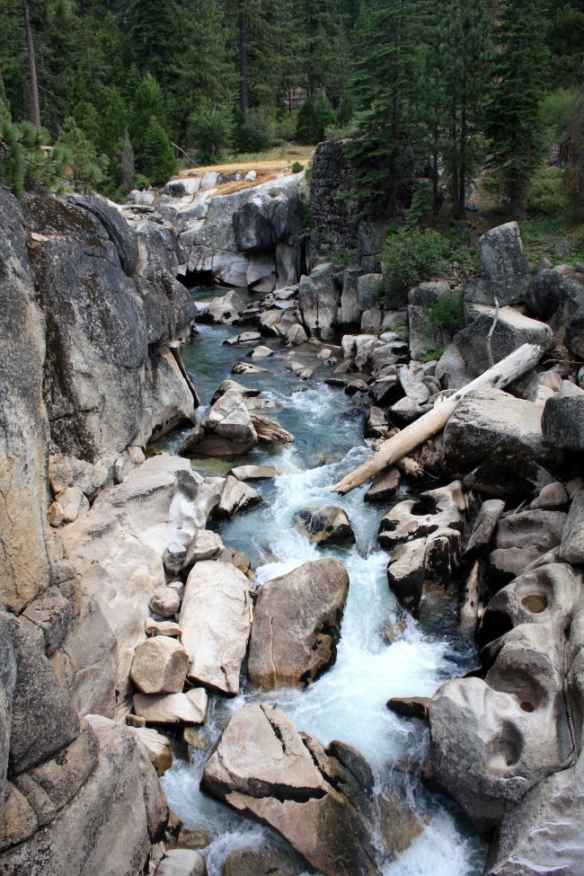
Stanislaus River photo by adam blauert
Trails Outside of Wilderness Areas
A number of excellent trails are found outside of the wilderness areas. Details can be found in some of the books listed below. You can also read some short descriptions at this site: www.fs.usda.gov/activity/stanislaus/recreation/hiking/?recid=14833&actid=50.
Books, Maps, and Other Resources
Although web-based resources are great for planning a trip, cellular service, internet, and electric power are hard to come by in much of the forest.
If you can store electronic resources on your device and have well-charged batteries, you may be able to continue to access your information this way. It’s always good, however, to have some paper resources. Print out information from the internet and bring both maps and books.
The general guide produced by Stanislaus National Forest is invaluable to have with you, especially if your plans change while on a trip. Weather and other elements outside of your control often require flexibility.
Books
Unfortunately there is no single book that comprehensively covers this area. For backpacking, Sierra North from Wilderness Press is a great choice.
For shorter day hikes, pick up a copy of California Hiking by Stienstra and Brown. Not only does this book highlight the best day hikes in Stanislaus National Forest, it is also an excellent resource for the entire state with a total of 1,000 hike routes.
Emigrant Wilderness published by Tom Harrison Maps Carson-Iceberg, Emigrant, and Mokelumne Wilderness Areas published by National Geographic The Forest Service also publishes separate maps for each wilderness area For more detailed hiking maps, check the USGS website for 7.5 and 15 minute sections. You can order printed copies of these maps or download free electronic copies.
Maps
It’s good to have a general highway map, but if you plan to explore off the main roads the Stanislaus National Forest Map is one of the most important things to have with you. In addition to roads and trails, it also shows campgrounds, ranger stations, supply locations, and recreation areas. It supplements the general guide to the forest (see above).
For some reason it is hard to find on the internet. Your best source is the website of the U.S. Geological Survey where you can buy it for $12: store.usgs.gov.
You can also purchase it at a ranger station.
For hiking or backpacking, the following maps are the top choices:No matter what resources you use, always call a ranger station to verify current conditions before you leave on a trip.
Conditions are always changing and even the official websites can be badly out of date.
Campground Camping
Within Stanislaus National Forest you’ll find 47 campgrounds.
You can also find a complete listing at: www.fs.usda.gov/activity/stanislaus/recreation/camping-cabins/?recid=14833&actid=29.
Some campgrounds are reservable in advance. You can search for reservable campsites by going to: www.recreation.gov.
Dispersed Camping
Camping outside a campground (usually referred to as “dispersed camping”) is permitted in areas of the forest where signs do not specifically prohibit it.
You can always check with a ranger station before you set up camp. In order to have a campfire you need a California Campfire Permit, available at any ranger station. You can also take an online quiz and get one issued electronically by going to: www.fs.fed.us/r5/sequoia/passespermits/campfire_permit/campfire-index.html.
As long as you follow the rules on the permit and make sure that you have chosen a safe site, your campfire is legal. Before your trip you should also make sure that additional campfire restrictions have not been put in place.
In dry years campfires are sometimes prohibited outside of established campgrounds.
Ranger-Led Activities
A variety of programs and hikes for all ages and ability levels are offered throughout the year. You can find up-to-schedules for each ranger district at: http://www.3forests.us/stanislaus.
Fishing: The forest abounds with streams, rivers, natural lakes, and reservoirs. Many are stocked and most are open to fishing. For regulations and stocking information, go to www.dfg.ca.gov.
Tom Stienstra’s California Fishing is a good general guide to the whole state, including Stanislaus National Forest.
Boating: Motorized fishing boats area allowed on the following lakes: Alpine, Beardsley, Cherry, Pinecrest, Spicer (in the half of the lake within Tuolumne County, but not in the Alpine County half), and Union. Water skiing and jet skis are allowed at Beardsley and Cherry.
Swimming: Swimming is allowed in most streams, rivers, and lakes, however it can be dangerous. Make sure that all people in your group have strong swimming abilities and you have flotation devices in case a rescue is necessary. Check with a ranger for current conditions. Generally Pinecrest Lake is one of the safest easily-accessible swimming destinations. Cherry Lake is also a good choice.
Dogs
Dogs are welcome on trails and in campgrounds in national forests as long as they are on-leash and well-behaved. They are not permitted on trails in state or national parks. Dogs may be off-leash as long as they are under voice control within wilderness areas (except in the Carson Pass Management Area of the Mokelumne Wilderness).
Horses
Horses are permitted on trails within the national forest. For overnight trips they must be included on your wilderness permit. Check with the ranger station for the best trail parking for horse trailers. Day rides and overnight pack trips are offered by:
Kennedy Meadows Pack Station: www.kennedymeadows.com/
Aspen Meadow Pack Station: aspenmeadowpackstation.com/
Leavitt Meadows Pack Station: www.leavittmeadows.com/
If you are not up to carrying all your gear or if you want to enjoy the wilderness with in a less strenuous way, a pack trip is a good choice.
Mountain Bikes
All roads and most trails outside of wilderness areas are open to mountain bikes. Check with a ranger for recommended trails and roads. Ann Marie Brown’s Northern California Biking is an excellent resource.
Off-Highway Vehicles and 4-Wheel Drive Vehicles
Many remote forest roads require 4-wheel drive and several areas are open to off-highway vehicles. For more information go to: www.fs.usda.gov/activity/stanislaus/recreation/ohv.
A copy of the Stanislaus National Forest map is extremely helpful in locating the best sites.
Hunting
The forest, including wilderness areas, is open to hunting according to DFG regulations. You can check regulations at www.dfg.ca.gov. Target shooting is prohibited in wilderness areas.
Winter Activities
Some roads and campgrounds are open through the winter months, especially in the lower elevations. Always carry tire chains and know how to install them. Highway 4 closes at the Bear Valley road junction and Highway 108 closes beyond Strawberry after the first major snowfall. Many lodging facilities are open year-round.
Downhill skiing and snowboarding
Offered at Dodge Ridge (Highway 108 at Pinecrest), and Bear Valley (Highway 4 near Lake Alpine). For more information:Snow Play Areas: Stanislaus National Forest is also a popular destination to play in the snow. Three “Sno-Parks” offer snow recreation for a $5 use fee.
You can find more information at: www.ohv.parks.ca.gov/pages/1233/files/sno-parks_2008-09.pdf.
Permits must be purchased before you reach the Sno-Park. Look for signs as you drive up Highway 108 or Highway 4 or call the ranger station for a current listing.
Snowshoeing and cross-country skiing
Along trails is also popular. Occasionally ranger-led snow activities are offered. Check with the ranger station for details. If none are offered, try Yosemite or Sequoia National Parks.
To find your own route, pick up a copy of Best Snowshoe Trails of California by Mark White. www.dodgeridge.com/sitewww.bearvalley.com
Snowmobile Trails
For snowmobiling information go to www.fs.usda.gov/activity/stanislaus/recreation/wintersports/?recid=14833&actid=92 or call the ranger station.
Milliken Museum and Los Banos Historic Sites

Photo by adam Blauert
Treasure trove of artifacts
With people, it’s what’s on the inside that counts. The same is true for museums. Los Banos’ Milliken Museum may look like a 1960’s era elementary school building on the outside, but inside you’ll find a treasure trove of artifacts and history.

Milliken Museum 4 Miller Buggy PHOTO BY ADAM BLAUERT
Want to see evidence of some of the species that lived here in prehistoric times or artifacts from the Native Americans who first settled our valley?
Want to know more about Henry Miller who led the development of the Westside’s agriculture and the town of Los Banos? Interested in seeing photos of destruction in Los Banos caused by the 1906 San Francisco Earthquake? Do you enjoy learning about the technology of home, business, farm, and community life in the past century?
Milliken Museum PHOTO BY ADAM BLAUERT
If you answered “yes” to any of the above, then you’ll probably enjoy a visit to the museum.
Having not visited in several years, I stopped in a couple of months ago. The museum has recently reopened following a transfer of the building’s ownership and some necessary repairs that kept it closed through the winter.
Ralph Leroy Milliken
Local farmer, mail carrier, and historian Ralph Leroy Milliken started the museum’s collection in 1954 with documents, artifacts, and oral histories. He served as the museum’s curator until his death in 1970.
In recognition of his pioneering effort, the museum has renamed for him.

Milliken Museum PHOTO BY ADAM BLAUERT
Today, enthusiastic volunteers staff the museum and carry on the tradition that he began.
For those who want to learn more about local history, the museum sells several books written by Milliken and other local historians.
Statue of Henry Miller
Allow at least an hour to appreciate the museum’s collection. While you’re in Los Banos, don’t miss the statue of Henry Miller located at 6th and H Streets.
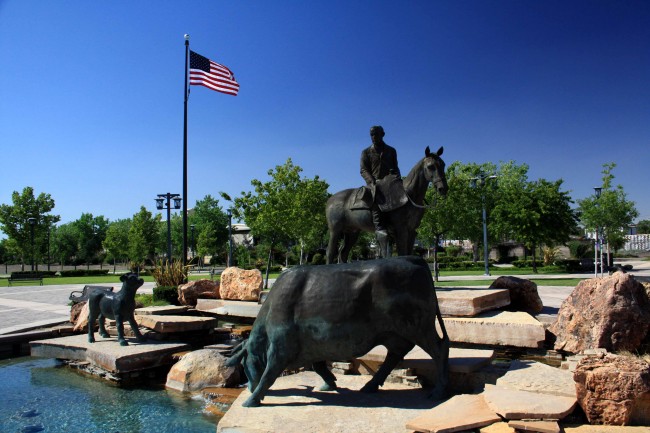
Henry Miller Statue PHOTO BY ADAM BLAUERT
You can then walk or drive around the area between H Street and Highway 152.
This is Los Banos’ historic downtown and there are many interesting old buildings to see. If you’re hungry there are plenty of places to get a bite to eat including the legendary Wool Growers Basque Restaurant, a Westside institution for 120 years.
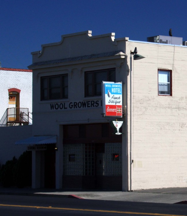
Wool Growers Restaurant PHOTO BY ADAM BLAUERT
The name comes from the work of sheepherding done by many of the early Basque settlers of the county. Hearty multi-course meals are served family-style in a dining room that has hardly changed in 50 years.
It’s the perfect place to end a “history trip.” Just don’t forget to bring cash as it is the only form of payment accepted at Wool Growers. If you’re looking for something else to complete your trip, stop by the nearby San Luis National Wildlife Refuge to see tule elk and waterfowl.
Near the refuge entrance you’ll see the Camp San Luis Adobe, the oldest intact building in Merced County.
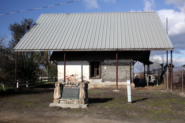
San Luis Camp Adobe PHOTO BY ADAM BLAUERT
Location and for more information
Built in 1848 by Francisco Perez Pacheco, the one-room house is now protected by a metal superstructure. The refuge is located north of Los Banos on Wolfsen Road.
The Milliken Museum is located adjacent to Los Banos County Park along Highway 152 (Pacheco Boulevard) between 7th and 9th Streets in Los Banos.
The park is also often known as “Pacheco County Park.” You can park in the parking area on Pacheco Boulevard or behind the museum on Washington Avenue.
For more information, call the museum at (209) 826-5505 or go to http://www.ourlosbanos.com/millikenmuseum.html.
The museum is open 1-4PM Tuesday through Sunday.

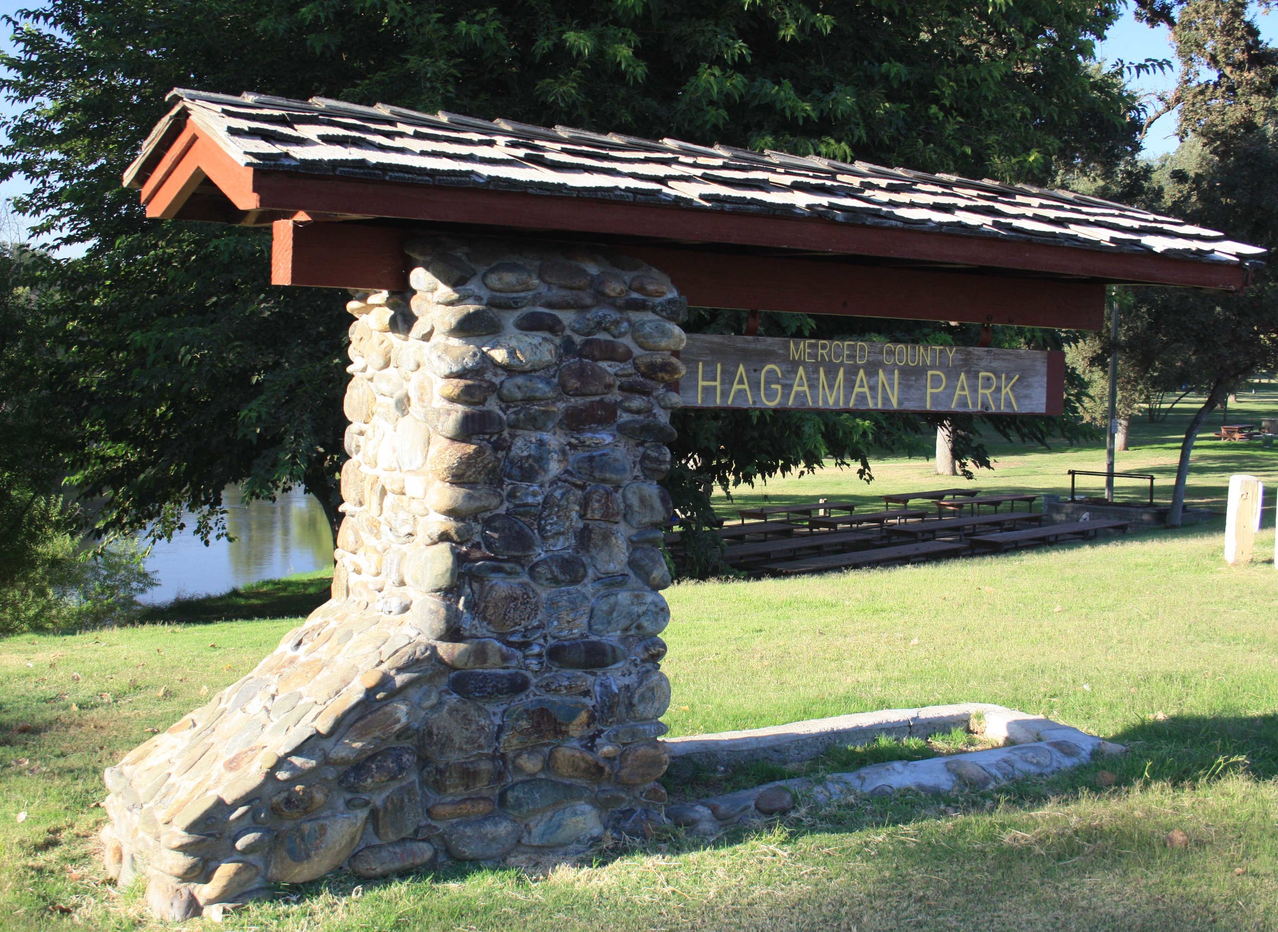
Visit Hagaman Park-Merced County
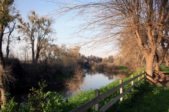
Photo by adam blauert
Hagaman Park
Located on a bluff above the Merced River in northwestern Merced County, Hagaman Park is especially popular with residents of the west side of the county. A large picnic area is available for rent.
Because of drownings, this area is not open to fishing and a fence runs along the bluff to discourage river access.
If you want to swim or fish in the Merced River, try George J. Hatfield State Recreation Area, or McConnell State Recreation Area.
Location
19914 River Road, Stevinson, CA (Intersection of River Road and Highway 165)
Distance from Merced: 24 miles
Distance from Los Banos: 23 miles
Facilities and activities
Flush restrooms
Drinking fountains
Picnic areas with tables, shelters, and BBQ grills
Group picnic areas and shelters
Playground
Hagaman Park
Website
Nearby Parks
Camping and picnic areas are available at

Turlock Museums

Photo by adam blauert
Museums in the Valley
Although part of Stanislaus County, Turlock is only 25 miles north of Merced – closer than some other towns that are within the county. Just like Merced, the core of Turlock was laid out by the Southern Pacific Railroad as it built southwards through the Central Valley in the early 1870’s.
The town had a slow start, finally taking off after the Turlock Irrigation District built canals to provide Tuolumne River water for irrigation. Large tracts of land were bought up by land companies and subdivided as “colonies” – the “colonists” could buy the land on credit and pay off part of the loan after each year’s harvest.

THS Entrance - PHOTO BY ADAM BLAUERT
History of the Central Valley
I grew interested in the town’s history after reading the following in Garden of the Sun, a history of the Central Valley written by Fresno State Professor Wallace Smith in 1939:
A pioneer wheat grower in that region asserted that the sand drifted against the stables in such high piles that pathways had to be shoveled before stock could be taken out.
The board fences used in the early days often broke from the weight of the sand piled against them by the winds surging through the passes in the Coast Range mountains.
Grasshoppers
Then came the grasshoppers. They were hatched in April, they appeared in full bib-and-tucker in May, they defoliated the vineyards and orchards in June, and only the bare peach pits, glistening like gnawed bones, were left on the trees in July.

THS Front - PHOTO BY ADAM BLAUERT
In 1904 an indignation meeting was held at Hilmar to protest against the alleged misrepresentations of the advertisements and circulars which had been sent out to prospective colonists.... But eventually the grasshoppers were destroyed by grass fires, night fires, and hopperdozers; water demonstrated the wonderful fertility of the apparently sandy soil; and homes were erected. (2nd edition, pp. 596-597)
My great-grandfather settled in Turlock just 10 years after the time described in Smith’s history, so I grew curious about learning more.
What drew him to Turlock? What were conditions like in 1914?
The next time I drove up to Turlock I made a stop at the Turlock Historical Society’s museum.
Historic Storefront
Located in a historic storefront at 108 S. Center Street, it is open Tuesdays and Thursdays from 11AM to 3PM. Admission is free and friendly volunteers are on hand to answer questions.
For more information go to: http://turlockhistoricalsociety.org/
or call (209) 668-7386.
The museum has an interesting collection of artifacts and antiques that illustrate the town’s development, life in the previous century, and the many peoples and cultures that came from around the world to settle in this area.
In addition to what I learned from the displays, I am continuing to learn more as I read a local history that I bought while at the museum: Streams in a Thirsty Land – A History of the Turlock Region.
Carnegie Arts Center in Turlock
If you make the trip up to Turlock, make sure you also plan to visit the Carnegie Arts Center at 250 North Broadway.
CAC 1916 Building - PHOTO BY ADAM BLAUERT
Originally established as one of Andrew Carnegie’s philanthropic enterprises to spread education, the library was built in 1916.
Nearly 150 Carnegie libraries were built in California during the early 1900’s. In 1968 the books were moved to a larger building and the former library was converted into a recreation and arts center.

CAC Old and New - PHOTO BY ADAM BLAUERT
While being renovated and expanded in 2005 it was gutted by fire.
Overwhelming community support made possible the restoration of the building and the addition of an 18,000 square foot exhibit, classroom and office space. Regular art classes are offered for all ages, though the biggest attractions for visitors from outside the county are the frequently-changing world-class art exhibits.
Admission is $5/person and the Arts Center is open Wednesday-Sunday from 10AM to 5PM.
For more information about the Carnegie Arts Center go to http://www.carnegieartsturlock.org
or call (209) 632-5761.

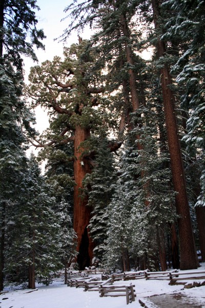
Calaveras Big Trees

Photo by adam blauert
The wonder of the Big Trees
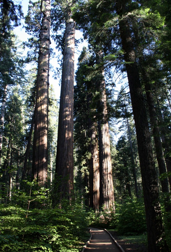
A shady grove of giant sequoias is a great place to be during the hot months of summer. Naturally-occurring populations of giant sequoias – scientific name Sequoiadendron giganteum, also known as Sierra redwoods – are found only along the western slope of our Sierra Nevada mountains.
These massive trees can grow to be over 300 feet tall and 100 feet in circumference, and can live for as many as 3,500 years.
Out of about 70 total groves of these amazing trees, only 9 are located north of the Kings River. Close to home, Yosemite’s spectacular Mariposa Grove is probably the best-known, with 500 mature sequoias.
During the summer it can be enjoyed on foot or by taking one of the tram tours offered by the park. Two smaller groves within the park, the Merced and the Tuolumne, are accessed from easy trails along the Tioga Road (Highway 120).
Highway 4
Another great place to see sequoias is Calaveras Big Trees State Park, located four miles east of Arnold on Highway 4. Distance-wise, the drive from Merced is only about 10 miles longer than the drive to Yosemite’s Mariposa Grove.
Mariposa Grove Grizzly Giant Photo by adam blauert
While Yosemite’s Mariposa Grove is a must-see while you’re in Yosemite, one of the disadvantages is that you can’t actually camp there. At Calaveras Big Trees, you’ll find 74 comfortable sites with flush toilets and coin-operated showers right next to the North Grove.
Camping in the Big Trees
The campground is so close to the grove that you can start your hike through the trees directly from your campsite. An additional 55 sites are located at Oak Hollow, halfway between the two groves.
A small number of more primitive “environmental campsites” are also available throughout the park.
The campsites at Big Trees are often much easier to book than sites within Yosemite.
The North Grove is one of two groves that make up the park. Located on the north side of North Fork of the Stanislaus River, it is the most popular of the two.
Much of this is due to the fact that the trail is accessible to just about everyone – wheelchairs and strollers are commonly seen – and you can see a lot in an easy 1.5 mile loop.

Discovery Tree Stump - PHOTO BY ADAM BLAUERT
Big Stump
One of the most memorable landmarks along the trail is the “big stump,” of the “Discovery Tree.” Cut down in the 1850’s, the stump was sanded smooth and used as a dance floor.
Today’s guests can stand on it to get an idea of just how massive these trees can be.

Pioneer Cabin Tree - PHOTO BY ADAM BLAUERT
Tunnel cut through a Big Tree
Further along the trail, the “Pioneer Cabin Tree” has a tunnel cut through it and is one of the most photographed trees in the park.
The trees of this grove were the first giant sequoias discovered by European-American settlers that the general public came to know about.
They immediately became a popular tourist destination.
The South Grove is located on the opposite side of the Stanislaus, a few miles down the Walter W. Smith Memorial Parkway.
Hiking
For a longer hike, this grove’s 5-mile loop trail will satisfy. Along the way you’ll see the Agassiz Tree, the park’s largest. 262 feet tall and almost 100 feet in circumference, it is an amazing sight.
A number of longer trails and unpaved fire roads connect major parts of the park, allowing longer hikes.
For a different landscape, try the 2.5 mile Lava Bluffs Trail above the river.
Calaveras Sequoias - PHOTO BY ADAM BLAUERT
In addition to hiking and camping, the park provides picnic areas and the river is open to fishing and swimming.
Day use is $8 a car
As a day trip or overnight camping destination, it is a great place to escape the summer heat.
It’s also a great place to visit year-round. The campground is open from March through November and the trails stay open in the snowy months for snowshoeing and cross-country skiing.
The park provides a safe place for kids to play in the snow. During a winter visit you can warm-up in the warming hut located at the North Grove.
In the fall maples, dogwoods, and shrubs can provide dramatic fall color among the evergreen sequoias, pines, and firs.
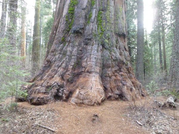
PHOTO BY ADAM BLAUERT
More information
The park’s website provides a lot of useful information for planning a trip.
Go to http://www.parks.ca.gov/?page_id=551
for more information or call the park at (209) 795-2334.
To book a campsite reservation, go to http://www.reserveamerica.com/
or call 1-800-444-7275.
Campsites are $35 a night and can accommodate recreational vehicles.
San Juan Bautista

PHOTO BY ADAM BLAUERT
Central Valley and the Merced river
In 1806 a Spanish expedition into the Central Valley identified the Merced River as the most likely site for the first inland mission settlement. The recommendation was never acted upon because of the hostility of the valley’s Native American tribes.
Although the original inhabitants of California had often been friendly to the Spanish during their first contacts, many tribes became more wary as disease spread, land was lost, and those who came to live at the missions were not allowed to leave.
Many natives who fled the mission life ended up joining valley and foothill tribes beyond the active control of the Spanish.Although a number of land grants were made in the Valley after Mexico rebelled from Spain in 1821, there was never very much Spanish or Mexican settlement.
In Merced County, the San Luis Gonzaga, Santa Rita, Orestimba, and Panoche grants were the only permanent settlement sites in the 1840’s.

Plaza Hall - PHOTO BY ADAM BLAUERT
San Juan Bautista, in San Benito County
The closest town and closest mission of any size were located at San Juan Bautista, in modern San Benito County.
50 miles west of the current town of Los Banos, the mission was close enough to the valley that padres traveled along Los Banos Creek to recruit and/or capture natives to come to the mission.
“Path of the Padres” hike
The annual “Path of the Padres” hike offered by California State Parks at Los Banos Creek Reservoir gives hikers a chance to retrace part of this route and to learn more about California’s early history. This hike is offered from February through April each year.
Call (209) 826-1197 at the beginning of the year to make reservations. Or website:
http://www.parks.ca.gov/Events/EventDetail.aspx?id=5098
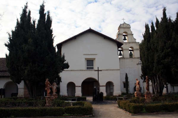
Today, San Juan Bautista is one of the best-preserved remnants of Spanish and Mexican California. It is a town that time has nearly forgotten, with a current population of less than 2,000.
Historic buildings dating from 1797 to the mid 1800’s surround three sides of the town’s plaza. The third side is open to the fertile San Juan Valley, with productive farmland stretching to the edge of the mountains.

Plaza Hotel - PHOTO BY ADAM BLAUERT
San Juan Bautista’s plaza
The only town center in California where all of the buildings date back to the mid-1800’s or before.
The Plaza Hotel, Castro-Breen Adobe, Plaza Hall and Plaza Stable have been restored to the way they would have been then and are open to the public as part of San Juan Bautista State Historic Park.
Hours
Closed on Mondays and holidays, they are open from 10AM to 4:30PM Tuesday-Sunday. There are few other places in California where it is so easy to imagine the 1840’s, when California was still a province of newly-independent Mexico.
It’s a great place to learn about California’s history.
For more information go to: http://www.parks.ca.gov/?page_id=563.

Mission Church - PHOTO BY ADAM BLAUERT
Active Church
The mission is still an active church but is open to the public from 9:30AM to 4:30PM seven days a week. Visitors can see exhibits about mission life and wander through the church and the garden.
The church is one of the biggest and most impressive among California’s 21 missions. The thick adobe walls keep it surprisingly cool in the summer. A statue in front of the church commemorates St. John the Baptist, the church’s patron saint.
For more information go to: http://www.oldmissionsjb.org/index.html.
SJB Rooster - PHOTO BY ADAM BLAUERT
Special events
One block from the plaza is 3rd Street, the town’s main street. Lined by a collection of historic structures, including adobes dating back to the 1800’s, the street has many great restaurants and interesting shops.
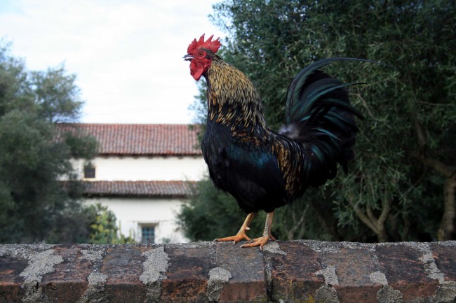
The historic core of the town is pedestrian friendly and quiet. You may see chickens wandering the streets or cats sleeping beneath the pews in the mission church.
The cats are permanent residents of the mission and help to keep rodents from taking over.
Despite its size, San Juan Bautista has a busy calendar of annual community events, celebrations, and festivals.
These include annual arts and crafts festivals, car shows, art studio tours, food, music, and history events.
For a regularly updated schedule of events, go to http://www.sanjuanbautistaca.com/.
Students and children
The state park offers a “living history day” on the first Saturday of each month with costumed docents and events for children. 50 miles west of Los Banos on Highway 156, San Juan Bautista is a great place for a day trip or an easy stop on the way to Monterey Bay.
If you have a student in 4th grade who is studying California history, a trip to San Juan Bautista can bring it to life.
Nearby Fremont Peak State Park offers a campground, an observatory, and a relatively easy but exciting ½ mile hike to a summit with 360 degree views of the coast, Monterey Bay, and the surrounding mountains, hills, and valleys.
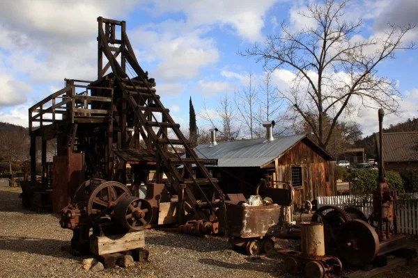
Gold Rush Towns of the Central Foothills

PHOTO BY ADAM BLAUERT
Gold Rush Towns of the Central Foothills
Gold, silver, and other minerals have been mined throughout California. Best known of all the mining areas is the “Mother Lode.” Stretching from El Dorado County south to Mariposa County, the lode is a continuous 120 mile long zone of hard rock gold deposits.
Today Highway 49 winds through many of the towns that sprung up during the Gold Rush of the 1850’s.
Foothill camps
The foothills between Merced County and Yosemite were a part of the Mother Lode known as the “Southern Mines.” The line separating them from the “Northern Mines” was drawn along the Mokelumne River, a few miles south of the town of Jackson.
Most mining camps were nothing more than temporary encampments established where a section of a river was panned or sluiced until the gold ran out.
Permanent towns developed in areas where more extensive operations spent decades tunneling deep into the hills.
Although most of these towns faded after the mines closed, tourism has brought some of them back to life. Visitors can explore buildings and artifacts from the 1800’s among shops, restaurants, and lodging facilities.
Below is a guide to some of the most interesting historic towns along the western edge ofYosemite from north to south.
All of these towns are interesting, but Columbia, Sonora, Groveland, and Mariposa are my top recommendations for Gold Rush towns that have the largest and most interesting historic areas.
Jamestown’s Rail town is also a must-see destination in the “Southern Mines.” Coulterville and La Grange small, but still very interesting.
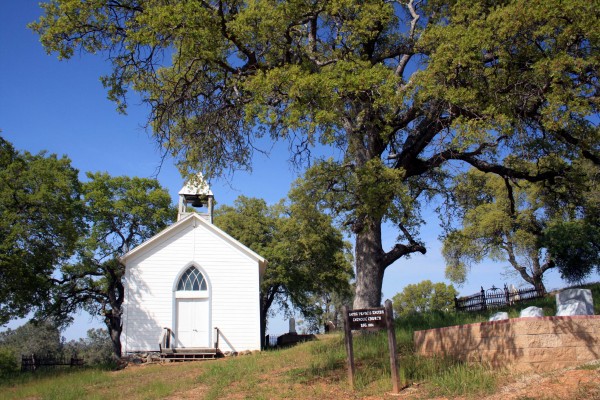
Largely bypassed by tourism, Hornitos has a mix of interesting ruins mingled with historic homes that are still inhabited.
Any historic town can be a great place to stop and as part of a trip into the Sierra Nevada and many offer lodging, including modern motels, historic hotels, and quaint bed and breakfast accommodations.
Be sure and check each town’s webpage lengths for special events – most of these towns offer a wide variety of celebrations and history-themed festivals throughout the year, especially during Independence Day and Christmas.
No matter where you visit, please be sure to respect private property and “No Trespassing” signs.
Columbia State Historic Park
Columbia was known as the “Gem of the Southern Mines” during the Gold Rush and it still sparkles.
Recognizing how well it had survived the years, the state of California began acquiring and renovating the buildings in 1945.

Columbia - PHOTO BY ADAM BLAUERT
Today the streets are closed to vehicles and Columbia is just about as close as you can get to stepping back in time.
The state park includes over 50 historic buildings, many of which house exhibits, restaurants, and shops that sell reproductions of products of the 1800’s.
Admission is free and the park hosts many special events throughout the year.
Many of these events have activities planned for children of all ages. The park is always open, but most businesses are only open from 10AM to 5PM. Lodging is available within historic hotels in the park.
For more information go to http://www.parks.ca.gov/default.asp?page_id=552,
http://www.parks.ca.gov/pages/552/files/ColumbiaSHPWeb2010.pdf
or http://www.columbiacalifornia.com/.
Stagecoach and horseback rides can be enjoyed on weekends

Columbia - PHOTO BY ADAM BLAUERT
The historic Fallon House Theatre offers live stage entertainment throughout the year http://www.sierrarep.com/.
Sonora
Not to be outdone by the “Gem of the Southern Mines,” Sonora was known as the “Queen of the Southern Mines.” Originally founded by miners from Sonora, Mexico, it is still a thriving town that maintains a lot of historic character in its extensive downtown area – the kind of place where you can spend a lot of time wandering around and enjoying the interesting architecture and shops.
The downtown area has been bypassed by Highway 108. Watch for exit signs if you enter the town by that route.
Residential areas around downtown contain picturesque Victorian homes.
The Tuolumne County Museum and History Center is housed in the old jail and presents excellent exhibits of the life in the pioneer days of Tuolumne County http://tchistory.org/index.html.
The Sonora Chamber of Commerce operates a daily trolley that connects Sonora with Columbia and Jamestown (May-Labor Day), allowing visitors to stay in one town and enjoy all three without having to drive.
More information is available at http://www.tuolumnecountytransit.com/HistoricTrolley.html
For information about lodging, restaurants, and activities, go to http://www.sonorachamber.com/
Jamestown
Rail town 1897 State Historic Park is Jamestown’s greatest attraction – this park preserves the roundhouse and engines of a short line railroad of the 1800’s. 40-minute rides on historic railcars are offered on weekends and Monday holidays throughout the summer.

Jamestown Railtown - PHOTO BY ADAM BLAUERT
The historic business district has many interesting buildings, although many date from a more recent time than the 1800’s. For information about lodging, food, and events,
go to http://www.tcvb.com/
Chinese Camp
Far less touristy than all of the other historic towns listed on this page (except Hornitos and Bear Valley), Chinese Camp has largely been bypassed by the modern world.
Chinese Camp St Xaviers - PHOTO BY ADAM BLAUERT
Founded by Chinese miners who were banished from other mining camps, a few structures still remain from the 1800’s, including St. Xavier’s Catholic Church.
Big Oak Flat
Smaller than neighboring Groveland, Big Oak Flat has a couple of historic buildings and a monument commemorating the now-vanished oak that gave the town its name. If you are on your way to Groveland or Yosemite, you might make a quick stop here.
Groveland
The main highway is also Groveland’s main street, lined with historic buildings.
The historic business district is smaller than that of Sonora, Mariposa, or Columbia, but still quite picturesque and worth a visit. The town’s original name was Garrotte because of its reputation for swift justice in the form of hanging.
The remains of a hanging tree can still be seen in the town. Groveland’s Iron Door Saloon claims to be the oldest bar in California and offers beverages, food, and live entertainment. Despite the name, families are welcome.
For more information about the town go to http://www.yosemitegold.com/yosemite/groveland.html.
La Grange
A sleepy town on Highway 132, several interesting historic buildings and a small museum evoke the wilder days of the 1850’s when La Grange was the county seat of Stanislaus County.

La Grange PHOTO BY ADAM BLAUERT
A tiny jail stands next to the museum and visitors can peer through the bars into the single cell. An iron bridge from the early 1900’s is open to pedestrians for a quiet stroll over the Tuolumne River.

La Grange Museum - PHOTO BY ADAM BLAUERT
Coulterville
The Northern Mariposa County History Center and the historic Hotel Jeffrey stand at the junction of Highways 49 and 132. Coulterville is one of the smaller Gold Rush era towns, but is picturesque and well-worth a visit.
“Whistling Billy,” a tiny antique locomotive that once hauled ore from the Mary Harrison Mine, stands in front of the History Center.
Bear Valley
Once the headquarters of John C. Fremont’s mining empire, a few buildings from the 1800’s still remain in this sleepy hamlet. Bear Valley is an interesting place to stop between Mariposa and Coulterville.
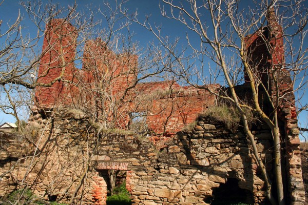
Hornitos
On a quiet day Hornitos may look like a true ghost town, though it still boasts a number of inhabitants.
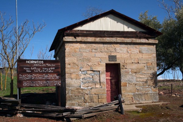
Hornitos Jail - PHOTO BY ADAM BLAUERT
The Hornitos Patrons Club hosts special events throughout the year and a famous candlelight procession to the cemetery on All Souls Day (November 2) draws hundreds of visitors.
Hornitos Ghirardelli Store - PHOTO BY ADAM BLAUERT
More information is available at http://www.hornitospc.com/.
The brick shell of the Ghirardelli Building is the remnant of a store owned by the man whose San Francisco chocolate company became known the world over.
Hite’s Cove
A true ghost town, this former settlement is reached by a 4.5 mile trail (9 miles round-trip). Located along the South Fork of the Merced River, John Hite operated a profitable mine along this bend in the river starting in the early 1860’s. At the height of operations, several dozen people lived there.
The mine shut down in the late 1800’s and a forest fire burned the structures in 1924, but rock walls and heavy iron machinery remain.
A few modern mining claims exist in this are and there is privately-owned land along the first ½ mile of the trial, so be sure to observe posted signs.
This is a great hike in the springtime when wildflowers cover the slopes of the canyon near the start of the trail.
The trail starts at the site of Savage’s Trading Post on Highway 140 between Midpines and El Portal.
Mariposa
The largest town between Merced and Yosemite on Highway 140, Mariposa’s main street has many historic buildings and interesting stores.
Once part of John C. Fremont’s empire, many of the streets are named for members of his family.

Mariposa Main Street PHOTO BY ADAM BLAUERT
Windows on the World Books has the best selections of books about local history and recreation that can be found. The historic courthouse, built in 1854 is the oldest still in use in California.

photo by brad haven
Church in Mariposa built in 1864.
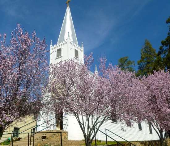
Photo by Brad haven
For more information on Mariposa, go to http://visitmariposa.net/

Mariposa History Center Stamp Mill - PHOTO BY ADAM BLAUERT
The Mariposa Museum and History Center
For information see website -(http://mariposamuseum.com/) The museum has a working stamp mill and offers some of the best displays of Gold Rush history anywhere in the Southern Mines and the California State Mining and Mineral Museum portrays the history of mining in California with extensive collections of minerals and gems
(http://www.parks.ca.gov/?page_id=588).
Catheys Valley
Although placer gold was mined here in the early days of the Gold Rush, Catheys Valley developed to supply ranches and farms in the lower foothills.
Although not a major town in any way, an old schoolhouse and blacksmith shop have been restored and moved to the county park on the eastern edge of town.

Catheys Valley Schoolhouse - PHOTO BY ADAM BLAUERT
Visitors can peer through the windows of the school and see what a typical rural school of the late 1800’s and early 1900’s looked like.
It’s a pleasant place to stop for a picnic on a spring or fall day while on the way to Yosemite.
Oakhurst
South of the Mother Lode and originally named Fresno Flats, Oakhurst developed to serve farms, ranches, and the logging industry that developed after the Gold Rush.
A number of interesting historic buildings from the 1800’s have been relocated to the Fresno Flats Historic Village and Park on Road 427.
The park is open from dawn to dusk and the buildings may be toured from 10AM to 2PM daily.
For more information call (559) 683-6570 or go to www.fresnoflatsmuseum.org.
The Oakhurst Chamber of Commerce offers information about accommodations and events: http://www.oakhurstchamber.com
Sonora, Mariposa Groveland, Oakhurst, and Columbia have the best selection of food, lodging, gas, and groceries. Jamestown and Coulterville offer all services with less variety. Big Oak Flat and La Grange have gas, limited supplies, and meals.
Catheys Valley and Chinese Camp offer gas and limited supplies.
A small store and a historic bar in Hornitos operate with limited hours. Bed and breakfast accommodations are offered in or around all of the towns.
For listings, try the following websites
Columbia Chamber of Commerce: http://www.columbiacalifornia.com/
Mariposa CountyTourism Bureau: http://www.homeofyosemite.com/
Another helpful Mariposa County site: http://visitmariposa.net/
Oakhurst Chamber of Commerce: http://www.oakhurstchamber.com/
Sonora Chamber of Commerce: http://www.sonorachamber.com/
Tuolumne County Chamber of Commerce: http://www.tcchamber.com/
Tuolumne CountyVisitors Bureau: http://www.tcvb.com/
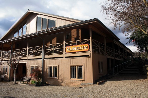
Mariposa County Museums

Photo by adam blauert
Mariposa County Museums
Mariposa County’s history and natural resources provide a wealth of interesting stories, knowledge, and sights.
Three excellent museums display some of these treasures to the public. Located adjacent to Merced County’s eastern boundary, Mariposa County is an easy day or weekend trip.
Museums can be enjoyed any time of year. They’re a great way to escape the heat of summer or the cold and wet of winter.
Even on a pleasant spring or fall day, there’s nothing wrong with spending a few hours indoors. If the weather is really bad, however, call in advance to make sure the museum will be open.
On a very wintry day last year I found the Mariposa Museum and History Center closed. Many stores in town were also closed and I was informed that this was due to the expectation of worse weather yet to come.
Mariposa Museum and History Center
5119 Jessie Street, Mariposa
Hours of Operation and Admission
10AM – 4PM daily except Thanksgiving, Christmas Eve, Christmas Day, New Year’s Eve, New Year’s Day, $4 adults, children under 18 free. Active duty military personnel and first responders in uniform or with active duty ID are also free.
Exhibits and Collections
The Mariposa Museum and History Center tells the story of Mariposa County from the Miwok Indians who first inhabited the area to the miners of the California Gold Rush and the ranchers who supplied the mining towns.
You can also learn about the early Chinese inhabitants of the county, John C. Fremont, Joaquin Murietta, the Yosemite Valley Railroad, and logging. The museum contains reproductions of early stores and homes and displays of mining technology and methods.
Various rotating exhibits provide something new for repeat visitors. Outside the walls of the museum is a large collection of mining and ranching equipment including an operational 5-stamp mill and a monitor used in hydraulic mining.
In addition, the grounds include historic Mariposa County buildings dating back to the 1850’s: the Counts House, the office and print shop of the Mariposa Gazette newspaper, a broom making shop, and a reconstruction of a typical blacksmith shop.
Other Facilities and Services
A picnic area is provided. The gift shop has an excellent selection of works on local history.
The museum’s website has a map for those interested in doing a historical walking tour of the town.
Research Opportunities
The museum contains a large collection of county records and historic photos, especially useful for family historians.
Appointments must be made in advance and a fee of $25/hour is charged.
Free access to the research library is one of the benefits provided to members of the museum.
Copies of documents and photos can be made for a small fee.
Tours
Group tours and school field trips can be arranged by contacting the museum.
The 5-stamp mill is often operated for groups.

Photo by Adam Blauert
Blacksmithing demonstrations and gold panning can be arranged.
Special Events and for more information
Go to www.mariposamuseum.com
or call (209) 966-2924.
Saint Joseph Church in Mariposa founded in 1857

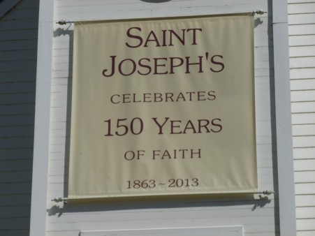
California State Mining and Mineral Museum
Photo by adam Blauert
Location: 5005 Fairgrounds Road, Mariposa
Hours of Operation: From October 1 through April 30, the museum is open 10AM – 4PM Thursday through Sunday.
From May 1 through September 30, the hours change to 10AM – 5PM.
Admission: $4 adults, children 12 and under are free.
Exhibits and Collections
The Mining and Mineral Museum displays both the mineral variety of California and the state’s mining history.
The museum’s collection includes thousands of specimens.
Collections are rotated and about 350 specimens are on display at any given time.
The 13.8 pound Fricot Nugget – the largest remaining intact mass of crystalline gold from the California Gold Rush –is one of the most popular attractions.
Visitors are often surprised to see the museum’s California diamonds. On the back side of the museum building is a life-size reproduction of a mining tunnel, open for exploration.
A “touch table provides children with an opportunity to handle mineral specimens.
Other Facilities and Services
Gift shop
Tours: School and group tours can be arranged.
Special Events
The museum presents a gem and mineral show in April with special exhibits and activities for children.
Activities for children are also offered on Labor Day Weekend when the Mariposa County Fair is held at the adjacent fairgrounds.
For More Information
Go to http://parks.ca.gov/?page_id=588
or call (209) 742-7625.
Northern Mariposa County History Center
PHOTO BY ADAM BLAUERT
Location: Intersection of Highways 132 and 49, Coulterville
Hours of Operation: 10AM – 4PM, Wednesday-Sunday, except major holidays.
Exhibits and Collections
Divided from the town of Mariposa by the deep Merced River Canyon, Coulterville has long been the population center of northern Mariposa County.
Today, Coulterville has its own museum that focuses on the unique history of this part of the county.
The museum’s displays are housed in two historic buildings that date back to 1856 and 1863.
PHOTO BY ADAM BLAUERT
Locally known as the “Coulterville Museum,” the Northern Mariposa County History Center displays and interprets a broad range of artifacts and stories.
Permanent exhibits chronicle the history of Coulterville and local mining and ranching operations.
Rotating exhibits provide new surprises for repeat visitors.
PHOTO BY ADAM BLAUERT
One of the most popular attractions is “Whistling Billy,” a small locomotive engine that hauled ore from the Mary Harrison Mine.
The engine is open to the public and visitors can climb inside the cab for photographs.
A building behind the museum houses wagons, mining, and farming equipment.
Other Facilities and Services: The gift shop offers a number of unique books that have been published by the museum.
Research Opportunities
The museum’s archive is open to researchers. Appointments must be made in advance.
Tours: Group and school tours can be arranged by contacting the museum. Tours are often led by docents in period dress.
A walking tour of the town of Coulterville is also available.
Special Events
The museum holds community breakfasts in the Old School House (two blocks away) on the 2ndSunday of each month.
Visitors often chose to show up for the breakfast and then tour the museum. Adults are $5, children are $3.
The museum hosts “Historical Afternoons on the third Saturday of each month in the spring and fall.
These living oral history presentations are held in the IOOF building (5030 Main Street, two blocks from the museum).
The cost is $3 per person.
For More Information: Go to http://coultervillemuseum.org
or call (209) 878-3015.
Castle Air Museum-Atwater

PHOTO BY ADAM BLAUERT
Castle Air Museum
Drawing visitors from across the country, Castle Air Museum is one of Merced County’s treasures. Located on the site of the former Castle Air Force Base (known as Merced Army Air Field during WWII), the museum a collection of 53 World War II, Korean War, and Vietnam Era aircraft including:
Boeing B-17G Flyingfortress
Boeing B-29 Superfortress
Boeing B-47E Stratojet
Boeing B-52D Stratofortress
Boeing KC-97L Stratofreighter
Boeing KC-135A Stratotanker
Convair RB-36H Peacemaker
Curtiss C-46D Commando
Douglas A-26B Invader
Douglas C-47A Skytrain
Lockheed SR-71 Blackbird
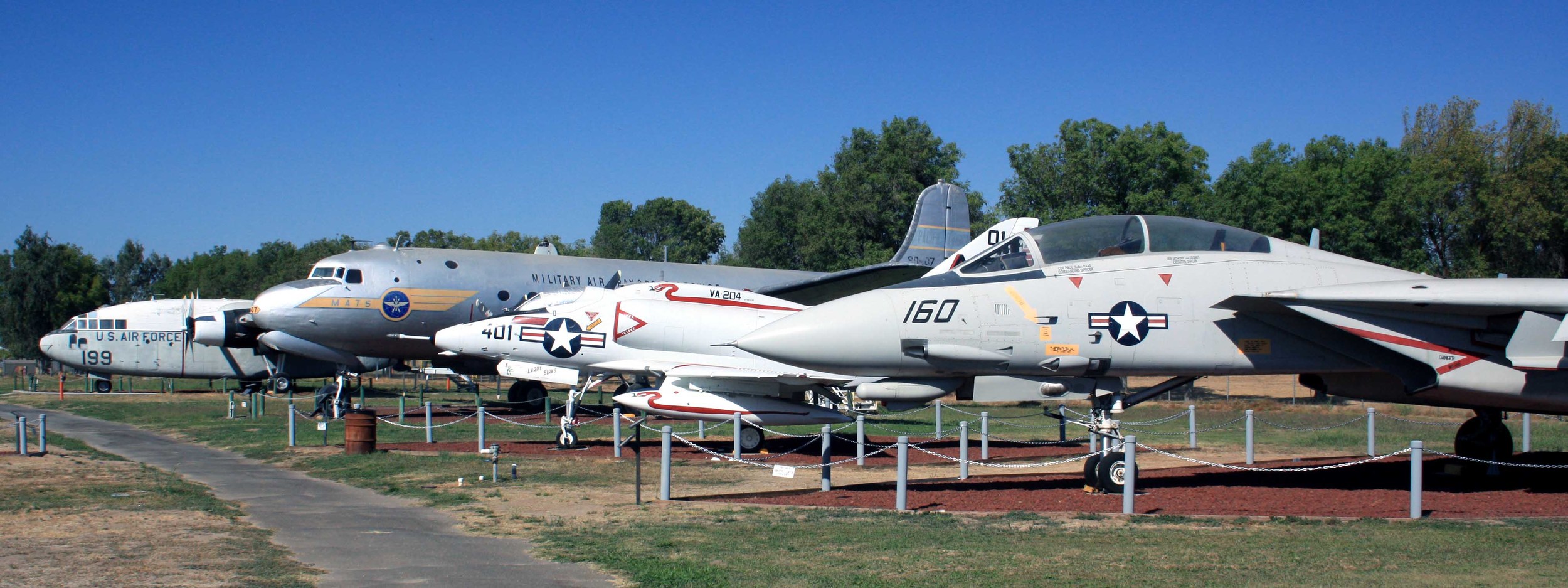
PHOTO BY ADAM BLAUERT
For a full list of planes on display, visit the museum’s website: http://www.castleairmuseum.org/

b52 - PHOTO BY ADAM BLAUERT
History come alive
This is a place where history truly comes alive. Visitors have close-up views of the planes from paved, handicapped-accessible walkways.
An indoor museum contains many additional Air Force and Army Air Corps artifacts and a B-52 simulator.
The museum holds annual “open cockpit” days when visitors can view the insides of many of the aircraft. Group tours can be arranged. The museum has a gift shop, café, and RV park with full hookups.

PHOTO BY ADAM BLAUERT
Facilities
Outdoor aircraft display, indoor museum, café, gift shop, and RV park with full hookups.
Special Events
“Open cockpit” days, veterans’ events, Halloween Fright Night, Christmas Plane Lane-see website for details and times. http://www.castleairmuseum.org/
Tours
Group tours can be arranged and school groups are welcome. The museum has produced a teachers’ guide to the museum with classroom activities.
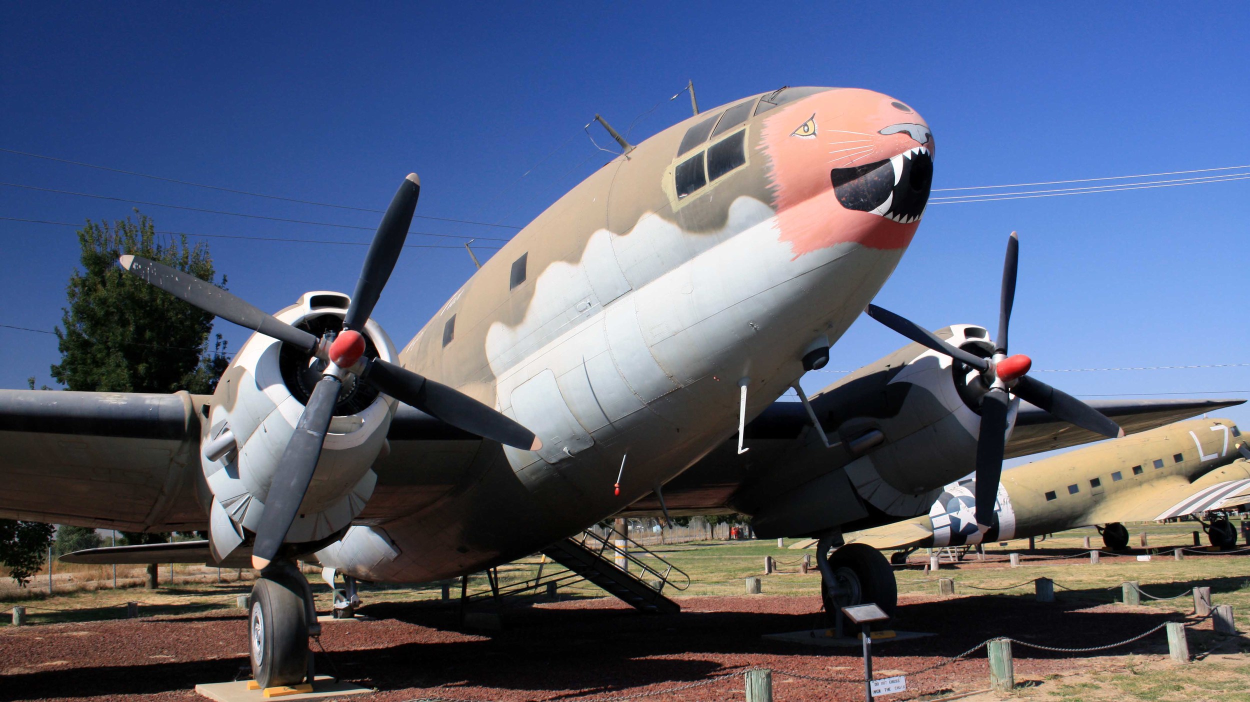
PHOTO BY ADAM BLAUERT
Hours and Entrance Fees
The museum is open every day of the year except Easter, Thanksgiving, Christmas, and New Year’s Day. Summer Hours (May – October) are 9-5 and Winter Hours (November-April) are 10-4.
Adults: $10.00 / $12.00 (Open Cockpit Day)
Seniors (60 & up): $8.00
Youths 6 - 17: $8.00
Children 5 & under (with paid adult): Free
Active Duty Military Personnel (with I.D.): Free
Family Pass: $30.00
Location
5050 Santa Fe Drive, Atwater, California 95301
Website
http://www.castleairmuseum.org
For more information: (209) 723-2178

Oakdale Cowboy Museum

PHOTO BY ADAM BLAUERT
Ranching continues today
Ranching has always been a big part of the economy and culture of central California. Started in the 1700’s when the Spanish drove the first cattle into the state, ranching continues today on thousands of ranches of throughout the state.
Poorly suited for irrigation and constrained by the state’s limited water resources, California’s dry hills abound with native grasses and provide an ideal range for cattle.
Because the state is dry so much of the year, ranches tend to be large with each head needing many acres to satisfy its grazing needs.
“Cowboy Capital of the World.”
Ranching life in California has generally followed the pattern of ranching life in other western states – with social gatherings centered around ranch work and competitions of skill – roundups, brandings, county fairs, and especially rodeos. Starting in the 1950’s, Oakdale began to establish itself as “Cowboy Capital of the World.” The town has a rich western heritage including not only the big rodeos of the last 60 years, but also a ranching history dating back to the 1850’s.
Oakdale Cowboy Museum
Much of this history is displayed and celebrated at the Oakdale Cowboy Museum. Located in downtown Oakdale’s old train station, the museum contains interesting collections of rodeo memorabilia, saddles, tack, ranching tools and implements, and historic photographs.
Permanent exhibits feature local cowboys who won big in the arena and local ranchers whose operations have been handed down from generation to generation since the early days of the county.
Although the museum isn’t especially large, there’s plenty to see and the volunteers on duty are helpful and knowledgeable. The first room contains permanent exhibits and a small gift shop.
The museum has published a number of books of local history that are available for purchase. The second room contains both permanent and temporary exhibits. The current temporary exhibit features the tools and techniques of saddle-making.
Other recent temporary exhibits have focused on the bronze cowboy sculptures of Jo Mora and the iconic stone fences and corrals of the local foothills.

Museum - PHOTO BY ADAM BLAUERT
The Oakdale Rodeo on the second weekend of April each year and the museum sponsors several special events annually. Check the museum’s website or call for more information.

Exhibits - PHOTO BY ADAM BLAUERT
Hours
The museum is open from 10AM to 2PM Monday through Saturday, except major holidays. If you are curious to learn more about the ranching and rodeo heritage of Central California, this is a great place to start.
No matter what your level of knowledge and/or experience with western lore, you’ll learn something here.

Branding Irons - PHOTO BY ADAM BLAUERT
The cowboy statue in front of the museum is a popular backdrop for photos.
About an hour’s drive from many towns in Merced County, Oakdale is an easy stop on the way to Sonora, Columbia, or Jamestown.
For more information
go to http://www.oakdalecowboymuseum.org/index.html
or call (209) 847-7049.
The museum is located at 355 East F Street, in Oakdale, across from the historic H-B Saloon.

Local Performing Arts

Photo by adam blauert
Local Valley performing arts
Within Merced County and an hour’s drive there are lots of venues to enjoy a wide range of performing arts and classic films.
(For information on local art venues, click on these links for the Merced Multicultural Arts Center and Turlock’s Carnegie Arts Center).

Playhouse Merced- PHOTO BY ADAM BLAUERT
Playhouse Merced
Since 1994, Playhouse Merced has offered a wide range of musical and non-musical productions that include new shows, classics, and pieces written for children and families.
Averaging over 12 productions a year, it’s a great place to enjoy performances by members of our community and by visiting artists. Performances are generally staged with the audience seated on three sides of the stage, close to the action.
The theater is located in downtown Merced, near Bob Hart Square.
For more information go to http://www.playhousemerced.com/index.html
or call (209) 725-8587.
Merced Theatre
After a complete restoration to its 1931 movie palace grandeur, the Merced Theatre reopened in 2012. It now regularly features live music, comedy, classic films, community productions, and the Merced Symphony (http://www.mercedsymphony.org/index.html / 209-383-3277).
For more information about the theatre go to
http://www.mercedtheatre.org/ or call 209-381-0500.
The Merced Shakespearefest
(http://www.mercedshakespearefest.org/ /
209-723-3265) performs at both the Merced Theatre and the open air theatre in Applegate Park.
Merced College’s Theatre Department
also offers drama, music, dance, and travelogues throughout the year.
For more information and for a schedule of current and upcoming performances, go to:http://www.mccd.edu/thearts/ or call (209) 386-6644.
CSU Stanislaus’ Department of Music
presents recitals and concerts throughout the year at the college’s Turlock campus. The Theatre Department also offers a variety of dramatic performances.
For music information go to http://www.csustan.edu/soa/musictickets.html
and for drama go to http://www.csustan.edu/soa/theatretickets.html.
You can also call (209) 667-3959 for information about both.
The Turlock Community Theatre
Hosts a wide range of national and local musicians and comedians throughout the year (http://turlocktheatre.org/index.html /
(209) 668-1169).
Gallo Center - PHOTO BY ADAM BLAUERT
Gallo Center
Modesto’s premiere performing arts venue is the Gallo Center, featuring nationally-known musicians, drama, and comedy.
Two years ago, I enjoyed seeing Hal Holbrook (86 years old at the time!) perform his one-man Mark Twain Tonight! show here. That’s the kind of talent that the Gallo Center attracts.
It’s also home to the Modesto SymphonyOrchestra (http://www.modestosymphony.org/ / 209- 523-4156) and the Townsend Opera (http://townsendopera.com/ / 209-523-6426).
For more information about the Gallo Center go to http://www.galloarts.org/
or call (209) 338-2100.
Modesto’s historic art deco State Theatre
Offers both live performances and classic films (http://www.thestate.org/ 209-527-4697).
MJC
The students and faculty of Modesto Junior College regularly present dramatic, musical, and dance performances (http://www.mjc.edu/general/news/eventstix.html / 209-575-6776).
West Side Theatre
West of Modesto, Newman’s historic West Side Theatre features a wide range of regional and national music talent (http://www.westsidetheatre.org/ /
209-862-4490).
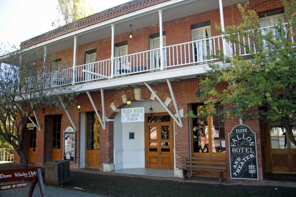
Fallon House Columbia - PHOTO BY ADAM BLAUERT
Columbia
To the east, the Sierra Repertory Theatre offers performances in both the East Sonora Theatre and the historic Fallon House Theatre in Columbia State Historic Park (http://www.sierrarep.org/index.html 209-532-3120).
Fresno area
To the south, Fresno boasts a wide range of performing arts options and venues. At the Fresno Convention Center, the Saroyan Theatre provides a large setting for traveling dramatic and musical performances, and for the Fresno Ballet Theatre (http://www.valleyperformingartscouncil.org/Site_4/Home.html),
Fresno Grand Opera (http://www.fresnograndopera.org/ or call 559-442-5649)
and Fresno Philharmonic (http://www.fresnophil.org/ / 559-261-0600). Also part of the Convention Center, Selland Arena hosts a wide range of events from basketball to Disney on Ice.
For more information about the Fresno Convention Center, go to http://www.fresnoconventioncenter.com/.
Also in downtown Fresno, the Warnors Theatre hosts live music and historic silent films accompanied by live organ music (as they were often originally shown in the early 1900’s). For more information go to http://www.warnors.org/ or call (559) 264-2848.
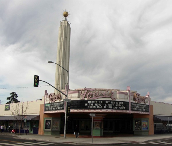
Tower Theatre - PHOTO BY ADAM BLAUERT
In Fresno’s Tower District, the historic art deco Tower Theatre also offers dramatic performances, music, and comedy (http://www.towertheatrefresno.com/ / 559-485-9050).
Roger Rocka’s Dinner Theater presents classic musicals paired with excellent food http://rogerrockas.com/ / (559-266-9494).
Fresno’s Save Mart Center is part of Fresno State University. It features large-scale concerts and sporting events.
Major national and international talent is often seen here performing for large crowds. Andrea Bocelli performed at Center’s opening and upcoming shows include Tim McGraw, Lady Antebellum, and Bruno Mars.
For more information go to http://www.savemartcenter.com/
or call (559) 347-3400.
Fresno State’s Theatre Department presents regular concerts, dramatic productions, and dance performances on the university campus (http://www.fresnostate.edu/artshum/theatrearts/ / 559-278-2216).
Fresno City College offers a wide range of dramatic performance, music, and dance – including the annual City Jazz Festival ( http://www.fresnocitycollege.edu/index.aspx?page=1719 / 559-442-8221).
Until I started compiling this list of performing arts venues, I really didn’t realize how many options were so close to home. There’s a lot to enjoy without driving a long distance!
Note to parents
Unlike movies, live theatre doesn’t always come with “mature content” warnings.
Always check the suitability of a performance before planning a family outing. We had a few surprises during my growing up years!

Shinzen Japanese Garden

Photo by adam blauert
Shinzen Friendship Garden in Woodward Park
Several times over the last few years, my wife and I have found ourselves in Fresno with time on our hands. Each of these times we have found interesting and enjoyable things to do – and most of them seem surprisingly little-known, even to people who live in Fresno.
Our most recent discovery was the Shinzen Friendship Garden in Woodward Park. Since we hadn’t heard much about it, we didn’t expect a whole lot. To our surprise, we found a stunning, meticulously manicured paradise with mature trees, plenty of shade, flowers, ponds, creeks, peacocks, and koi fish.
It’s the most beautiful and peaceful spot I’ve seen in any Central Valley city.
Photo by Adam Blauert
Bonsai Festival
The day of our visit also happened to be the annual Bonsai Festival. There were hundreds of bonsai trees – some of the more than half a century old – to enjoy. Several vendors had unique Japanese and garden-themed art and other items for sale.
Food was available at lunch time and live traditional Japanese music was being performed in the tea garden. The festival is held every April.
Information about the garden
For more information about the garden, the Bonsai Festival, and other annual events,
go to: https://www.shinzenjapanesegarden.org/ or call (559) 840-1264.
Guided tours can be scheduled and the garden can also be a great location to take family portraits. A special permit is required for this kind of use, but easy to obtain through the website.
The garden can be rented for weddings, meetings, and other social events.

Photo by Adam Blauert
Check the website to find out what current conditions are before you plan your visit. Although the spring bloom is probably the most popular season to visit, the garden is also an excellent fall destination with Japanese maples and other tree species putting on a vibrant leaf show.
Until the end of September, the garden is open on weekdays from 5PM until dusk and on weekends from 10AM until dusk. Starting October 1st and continuing through March 31st, the garden is only open on weekends from 10AM until 5PM.
Summer hours resume on April 1st. In addition to the $5/car fee to enter Woodward Park, a separate per person charge of $3 for ages 15-61 or $0.50 for ages 4-14 and seniors 62 and older is collected.
Children under 4 years old are free and the max charge for a family (up to 5 people) is $5.

Photo by Adam Blauert
Not far from Merced
If you live in Merced, the drive takes just over an hour. Located at 114 W. Audubon Drive in Fresno’s Woodward Park, take the Friant Road exit from Highway 41 and turn east on Friant Road.
Follow the signs for Woodward Park. It is located adjacent to the highway. The fee to enter the park is $5 per car. If a senior citizen is a driver or passenger in the vehicle it is reduced to $3 and it is free with a disabled parking permit.
The garden began in 1981 and was planted to honor Fresno’s sister city of Kochi, Japan. In the 33 years since that time, its plantings have matured into one of the most beautiful gardens within a day’s drive from home.
With the closing of Hanford’s Clark Center for Japanese Art and Culture in the summer of 2015, the Center’s remarkable collection of bonsai will be permanently transferred to Shinzen.
The grand opening of this collection is expected to take place sometime after July 2015 and it will make Shinzen even more exceptional.
If you make the trip you can also enjoy Woodward Park’s picnic areas, trails, and playgrounds. During the summer months, the park’s amphitheater that is frequently the site of concerts.
Designed to be both a public park and a bird sanctuary, large tree-ringed ponds are the centerpiece of the landscape. The park can be a great place to see wildlife.
Other locations to visit while in Fresno
While in Fresno, there are plenty of other things to enjoy. Some of the best include:


Photos below were taken in November of 2017


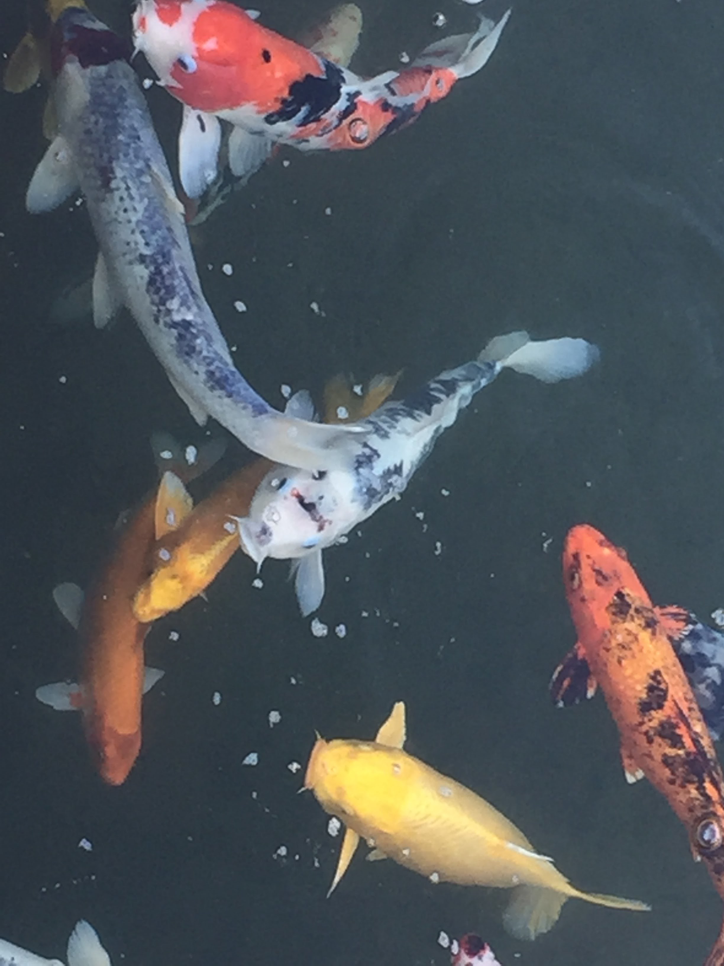


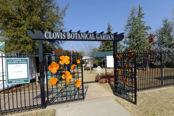
Clovis Botanical Garden

Photo by adam blauert

Clovis Botanical - PHOTO BY ADAM BLAUERT
It’s popular and easy to make jokes about the Fresno area. In some ways, this generally-accepted negativity makes the area’s hidden gems even more surprising. The most recent one that I’ve discovered is the Clovis Botanical Garden.
Having some unexpected free time between two appointments and after discussing several options, we eventually decided to check out the garden.
Despite the fact that this is the dormant season for many plants, the garden was still quite interesting. We really enjoyed our visit and plan to return in the spring.
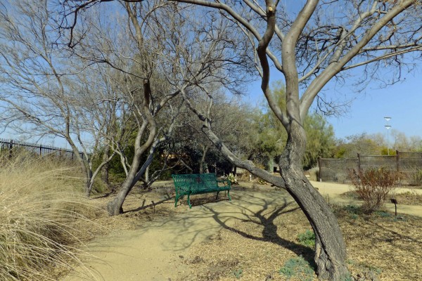
Desert Willows - PHOTO BY ADAM BLAUERT
The best thing about the garden is that it is a great place to learn about water-wise plants that tolerate our hot summers and cool winters. It was designed to become “the premier regional garden for demonstrating wise water use in Valley landscapes.”
Although we’d been interested in learning about how to plant native plants and other low-water species, we hadn’t realized that it would be so easy and enjoyable to learn about until we ended up at the botanical garden almost by accident.
The Garden started with one acre and is in the process of developing three more. The plants are a mix of native species, plants from similar climates around the world, and hybrids – including trees, shrubs, ground cover, and various perennials – all of which are clearly labeled.
If you’re thinking of transitioning to landscaping that uses less water, this is a great place to see what your options are. We wrote down the names of several plants that we liked.

Acacia - PHOTO BY ADAM BLAUERT
Several free pamphlets about recommended plants are available to visitors. My favorite has been “Sensational 70: Seventy Plants Friendly to Central Valley Landscapes.”
All the included plants are attractive, water-wise, non-invasive, and regularly available in retail nurseries.
Another pamphlet produced by the City of Fresno featured a link to a useful website of water-wise plants: http://www.fresno.watersavingplants.com/.
The garden also offers a demonstration planting of the drought-tolerant UC Verde Buffalograss developed by UC Davis and UC Riverside. This grass uses 75% less water than traditional lawns, only needs to be mowed once every 2-3 weeks, is designed for regular foot traffic, and produces few allergens.
The garden is operated by a nonprofit organization and all the work of maintenance and planting is done by volunteers.
It is open Wednesday through Sunday from 9AM to 4PM and admission is free.
It is closed Mondays, Tuesdays, and the following holidays: January 1, July 4, Thanksgiving, December 24, and December 25. Group tours for all ages – including school groups – can be arranged in advance.

Winter Flowers - PHOTO BY ADAM BLAUERT
The Garden is adjacent to the Dry Creek Park, which offers a large variety of attractive playground equipment for children and picnic tables. The Dry Creek bike/pedestrian path connects the park and garden to many other destinations in Clovis.
With this year’s worrisome drought conditions, I can’t imagine a timelier place to have discovered last weekend than the Clovis Botanical Garden.
For more information go to: http://clovisbotanicalgarden.com/ or call (559) 298-3091.

Clovis Botanical - PHOTO BY ADAM BLAUERT
For upcoming events- Call or email Marge at (559) 323-5974 or cbgmarge@comcast.net.
Events can include workshops on water-wise gardening, an “Ask the Experts ‘Alley’” where guests can get gardening information and advice from a wide range of water and gardening experts, and a water-wise plant sale.
Local food trucks will provide a variety of lunch options.
For more information, email or call Georgia at (559) 287-2320 or gporcella@comcast.net.
Other locations to visit while in Fresno
While in Fresno, there are plenty of other things to enjoy. Some of the best include:

Moccasin Trout Hatchery
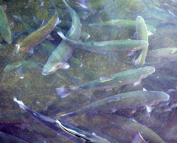
Photo by adam blauert
Fish and Game
In order to provide fishing opportunities for 38 million people, the California Department of Fish and Game grows trout and salmon in 21 hatcheries throughout the state and then stocks them in lakes and rivers to supplement the natural populations. Much of this is done by truck, however in roadless areas airplanes are used.
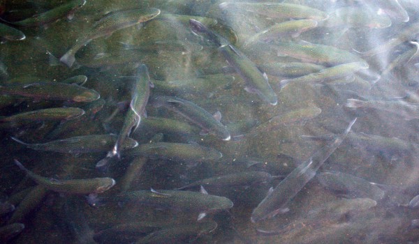
Large Trout - PHOTO BY ADAM BLAUERT
Moccasin hatchery
The closest trout hatchery to Merced County is located at Moccasin, along the northern route to Yosemite. For a map showing all of the DFG hatcheries in California, go to http://www.dfg.ca.gov/fish/Hatcheries/Moccasin/

Trout Swarming - PHOTO BY ADAM BLAUERT
Hours of operation
From 7:30AM to 3:30PM daily, visitors can observe and feed the rainbow trout at the Moccasin hatchery. The fish live and grow in long rectangular pools, protected from predators by a tall chain-link fence and overhead wires.
The largest fish – some of them very large – are located in a pool near the front of the hatchery. A sign indicates “show fish.”
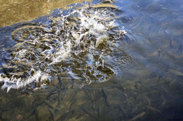
Trout Jumping - PHOTO BY ADAM BLAUERT
Bring quarters to feed the fish
Fish food is sold from a dispenser in the parking area. Bring quarters - $5 provided nearly an hour of fun the last time I visited. If you bring several children, more quarters may be necessary.
Tossing the food into the water creates a feeding frenzy. It is thrilling to watch swarms of beautiful fish jumping out of the water and moving great distances in the blink of an eye.
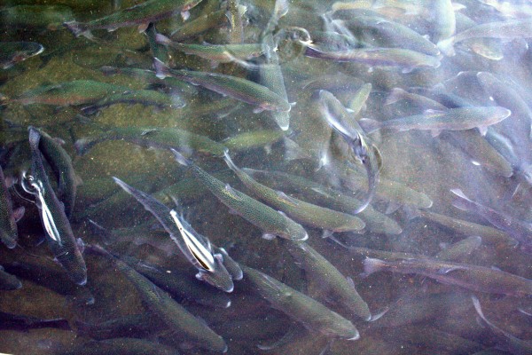
Large Trout - PHOTO BY ADAM BLAUERT
It’s great fun for all ages, especially for kids. The fish are conditioned to expect food from large vertical objects and a feeding frenzy may start when your shadow crosses the water, even if you don’t throw any food in.
In the winter months the surrounding mountains block the sun by 2PM. If you want to enjoy its warmth, arrive by noon.
Planning your visit
During the summer heat an early visit is recommended. Trying to catch jumping fish with your camera can be a lot of fun if you are a photographer. A polarizing filter is helpful to cut through the glare on the water.
The hatchery is located near the junction of Highways 120 and 49. If you come from the south via Highway 49, watch for a sign indicating a right hand turn for the hatchery just before you reach the Highway 120 junction. If you come from the west on 120, turn right on 49 and look for a signed left hand turn.
About 70 minutes from Merced, the hatchery is close to the historic towns of Coulterville, Chinese Camp, Big Oak Flat, and Groveland. It is also relatively close to Sonora, Jamestown, Columbia State Historic Park, and Railtown 1897 State Historic Park.
The BLM’s Red Hills Area is a great spot for a picnic or a hike in the fall, winter, or spring.
Red Hills is known for having an excellent wildflower display in March and April. If you are headed to or from Yosemite on Highway 120, the hatchery makes a convenient stop.
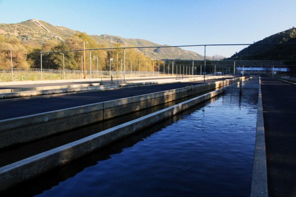
Hatchery - PHOTO BY ADAM BLAUERT
Hetch Hetchy
The buildings surrounding the hatchery pools are where fish are bred and hatched. The larger buildings and the pond beyond the hatchery complex are part of the Hetch Hetchy power generation system.
Water is diverted from the Tuolumne River through the large pipes that descend the mountains to the east of the hatchery (penstocks).
The great force of the descending water is turned into electrical power. In addition to providing electrical power, the Hetch Hetchy system supplies San Francisco with drinking water.
The diversion begins at the Hetch Hetchy Reservoir inside Yosemite National Park.
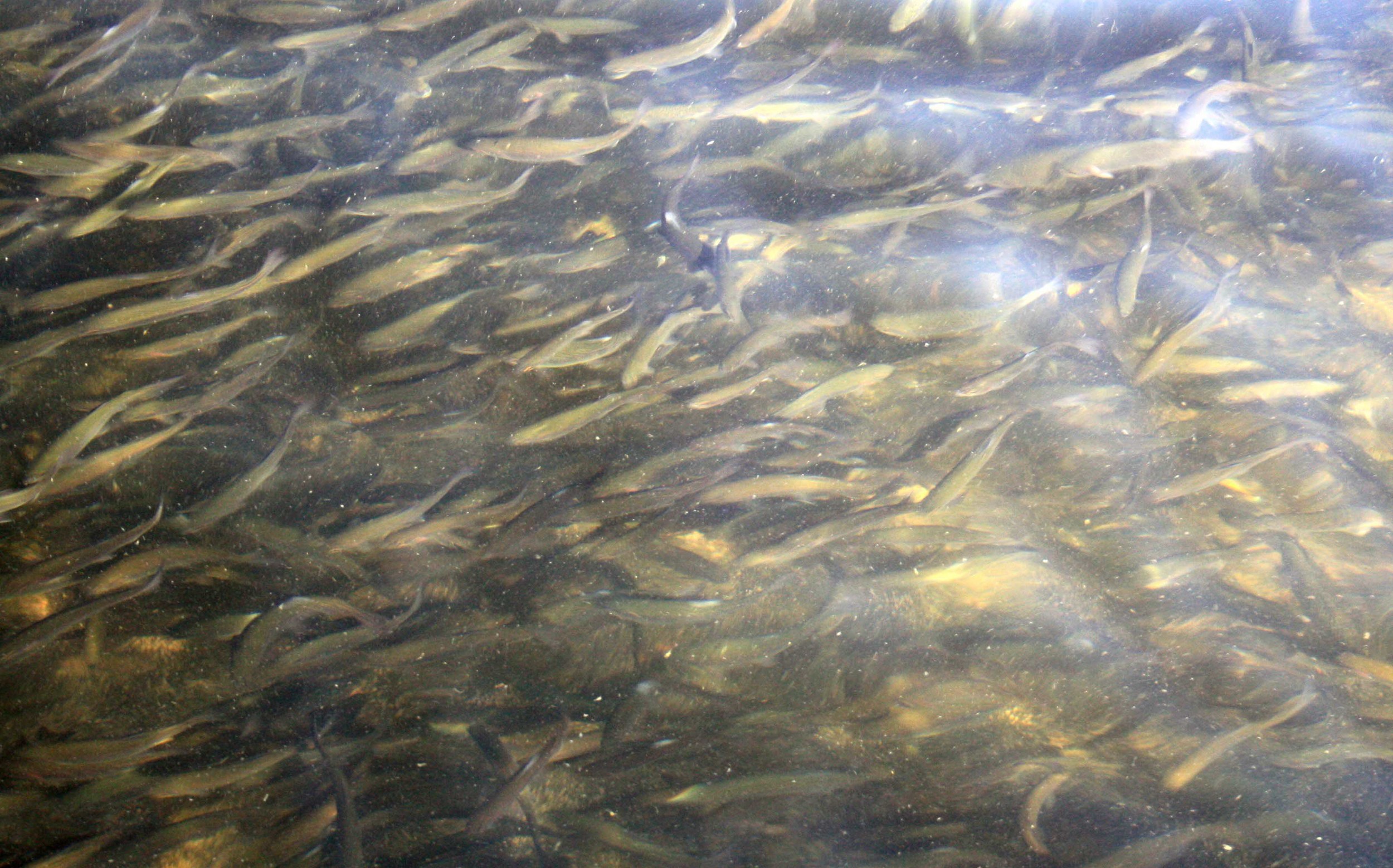
Medium Trout Underwater - PHOTO BY ADAM BLAUERT
Signs are posted warning hatchery visitors to stay off the concrete edges of the pools. Don’t feed the fish anything other than the food sold at the hatchery and don’t try to touch the fish.
To plan a school or group visit, contact the hatchery at http://www.dfg.ca.gov/fish/Hatcheries/Moccasin/

Adam Blauert, a high school teacher and avid outdoors enthusiast, has dedicated the majority of his life to Merced County. His passions include fishing, backpacking, delving into local history, and exploring the wonders of the western states.