

Sierra Foothill Conservancy

PHOTO BY ADAM BLAUERT
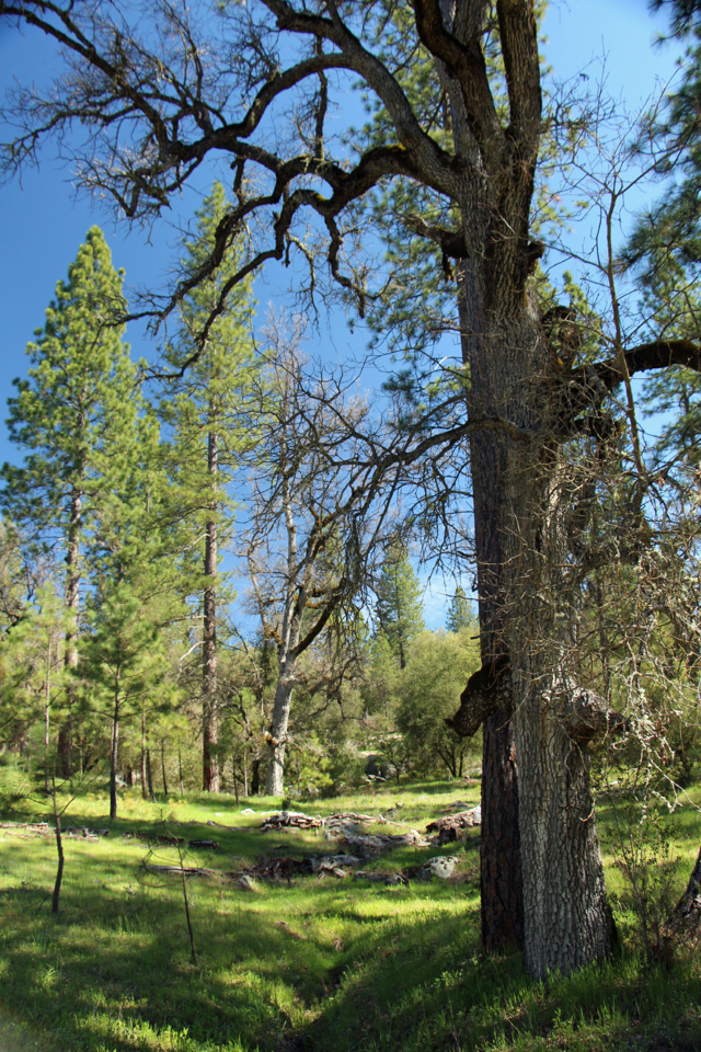
Most of the best hiking trails between Merced and Yosemite National Park are located on land surrounding the large reservoirs that provide water for farms, businesses, and homes. Much of the remaining land is privately owned, providing homes for families and food for the world. In the last couple of decades, some of that land has been put into conservation easements. These easements ensure that it will continue to be a part of the economy as grazing land and also ensure that it will not become urbanized.

Van der Ahe - PHOTO BY ADAM BLAUERT
Easements are voluntary and permanent legal decisions made by the landowners. Essentially they sell their development rights while continuing to run productive livestock operations. Easements help to preserve open space and a ranching-based economy without government ownership of the land or removal of the land from the economy.
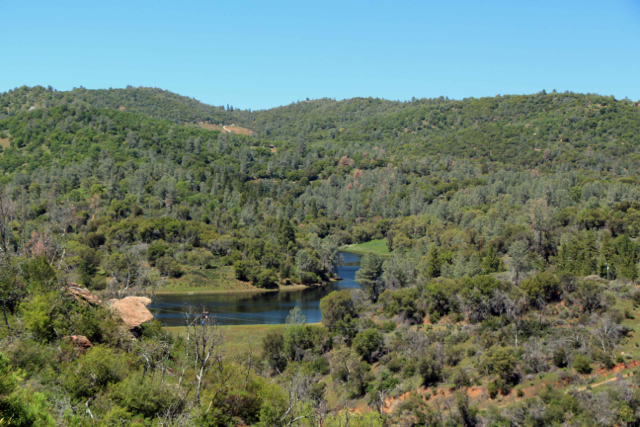
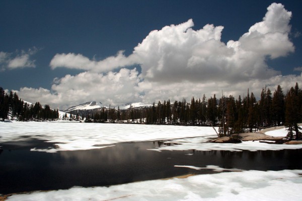
Stockton Creek - PHOTO BY ADAM BLAUERT
Many families who have chosen to put an easement on their land have lived on the land and loved it for generations. The easement is as a way to preserve it land for future generations, no matter whether their family continues to own it or not.

Stockton Creek - PHOTO BY ADAM BLAUERT
In the foothills of Mariposa, Madera, and Fresno Counties, a majority of these easements are overseen by the Sierra Foothill Conservancy. The Conservancy has developed strong working relationships with these landowners and the result is that many are willing to allow the Conservancy to hold classes and guided hikes on their properties. The Conservancy also owns and/or manages nine preserves where cattle generally remain part of the land’s management plan, but which are open to the public on a more frequent basis.
The Madera and Fresno County preserves
Three of these preserves – Stockton Creek, Feliciana Mountain, and Bean Creek – are located close to home in Mariposa County.
The Madera and Fresno County preserves are also within a driving distance of one and a half to two hours. Mariposa area classes and hikes may occur on the preserves or on easements in a wide range of elevation zones.
These easements include Striped Rock, Clark’s Valley, and ranch land near Hornitos, Bear Valley, and Darrah.

Van der Ahe - PHOTO BY ADAM BLAUERT
Hikes and classes
Hikes and classes aren’t offered during the intense heat of summer, but they will begin again in October and run through May. The majority of events occur as the weather improves between February and May.
This fall’s Mariposa County events – including a hike through oak woodlands to expansive views from the top of Striped Rock and an autumn-themed nature photography workshop at Stockton Creek – will be posted on the Conservancy’s website (www.sierrafoothill.org) by the middle of September.

Van der Ahe - PHOTO BY ADAM BLAUERT
Hikes
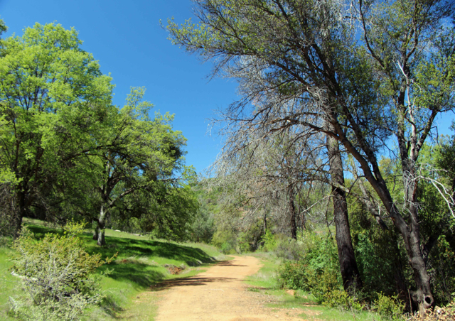
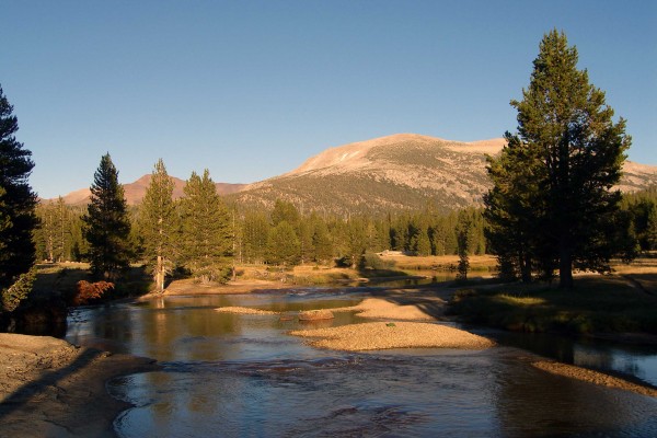
The relatively easy Stockton Creek Trail in the Stockton Creek Preserve near downtown Mariposa is open daily from sunrise to sunset.
The trail’s route includes Stockton Creek Reservoir (the source of Mariposa’s drinking water) and a ridge that overlooks the town of Mariposa with views of the surrounding mountains.
Most hikers start at water treatment facility at the end of Trabucco Road and climb over the ridge to the reservoir. You can also start on the south side of Highway 140, just east of the junction with Old Highway North.
Van der Ahe - PHOTO BY ADAM BLAUERT
Look for a turnout with a locked gate. There is a “walkaround” to the side of the gate. Eventually an additional section of trail will be built to connect the preserve with Slaughterhouse Road.
You can find easy-to-use hiking map at: http://www.sierrafoothill.org/index.php/land/preserves/stockton-creek/.
Stockton Creek - PHOTO BY ADAM BLAUERT
Power hikes
The Conservancy offers a broad range of hikes and classes. Designated “family hikes” are very easy and generally a good option for people of all ages. Many hikes and classes easy to moderate in difficulty.
More challenging “power hikes” may last all day and require some serious elevation gain – especially Tivy Mountain and the Table Mountain hikes that include Smith Basin.
All hikes are led by experienced guides who can explain the landscape, its plants and animals, and its history.
Classes offered on SFC preserves and easements include subjects such as birds, photography, native plants, astronomy, wildflowers, and trees.
The Sierra Foothill Conservancy does a great job of balancing habitat preservation with ranching, with a bonus of welcoming the public for informative and rewarding activities.
I’ve hiked several Sierra Foothill Conservancy trails and there are quite a few more that I hope to visit in the next couple of years. Perhaps I’ll see you on the trail!
Stockton Creek 2 - PHOTO BY ADAM BLAUERT
For more information, visit the Conservancy’s informative website: www.sierrafoothill.org.
The site details each of the preserves with stunning photos and offers a calendar of events.
You can contact the Mariposa office at (209) 742-5556 and the Prather office at (559) 855-3473.

George J. Hatfield Recreation Area Merced County

photo by adam blauert
George J. Hatfield Recreation Area
This state park has a mile of river frontage and plenty of shade. It’s proximity to the road and the poor condition of some of its facilities make it less favorable than some of the other parks on the river, but it still provides many excellent fishing opportunities.
Near the park is a historic bridge over the Merced River. Built in 1910, it is now open only to pedestrians and bikers. It provides nice views of the river.

Hatfield - PHOTO BY ADAM BLAUERT
Location
4394 North Kelly Road, Hilmar, CA
Distance from Merced: 30 miles
Distance from Los Banos: 29 miles
Size: 46.5 acres
Facilities and activities
Flush restrooms
Drinking fountains
Campgrounds/group campgrounds with BBQ grills/fire rings
Picnic areas with tables, shelters, and BBQ grills
Group picnic areas
Swimming area
Dogs allowed? Yes
Horses allowed? No
Hunting allowed? No
Fishing or boating?
Fishing can be good at George J. Hatfield Recreation Area. Rainbow trout and bass can be caught in the spring; catfish and perch throughout the year.
No boating ramp is provided, but it is possible to swim in the river or to launch a float tube or hand-carried boat.
Website
Hatfield Recreation (click Here)
Nearby Parks
Undeveloped Great Valley Grasslands State Park has a six mile hiking trail.

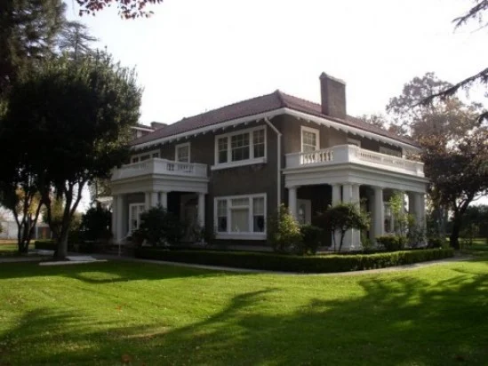
Kearney Park and Mansion

PHOTO BY ADAM BLAUERT
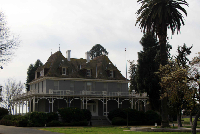
M. Theodore Kearney
During the mid-1800’s, the majority of people who visited the San Joaquin Valley couldn’t see the agricultural potential that would be unleashed through irrigation.
M. Theodore Kearney was one of the few who did and although his name may not be a household one, he played a major role in making the valley what it is today. The most visible legacies of his life are Fresno’s Kearney Mansion and Kearney Park.
Kearney started in 1875 by promoting and managing colony development systems in Fresno County. Land was subdivided and sold with irrigation and fencing provided, making grape and fruit growing both possible and affordable for middle class families.

Civil War - PHOTO BY ADAM BLAUERT
1883
In 1883 he began his biggest project – the Fruit Vale Estate. Kearney purchased 6,800 acres west of Fresno with the intention of making it the greatest agricultural colony yet established in the area.
Simply raising the investment capital to undertake the massive project – especially the irrigation system – required a three year trip to New York and Europe.
Work began as soon as he returned. Kearney selected 240 acres on the southern edge of his property for a park and grand estate that would serve as his headquarters.
He commissioned well-known landscape artist Rudolph Ulrich to design “Chateau Fresno Park” in what was then a barren plain. Within a few years the barrenness had been transformed into what was probably the best collection of trees, vines, shrubs, and roses in the United States.
Chateau Chenonceaux
In the center of it all, Kearney planned to build a five-story mansion based on the Chateau Chenonceaux in Tours, France. This ambitious plan was the culmination of the remarkable social and economic climb of a man who kept his working-class Irish immigrant background a closely-guarded secret in a time when it was not “respectable” to be Irish.
The chateau would be a place where Kearney could proudly entertain his European investors and friends.
Civil War - PHOTO BY ADAM BLAUERT
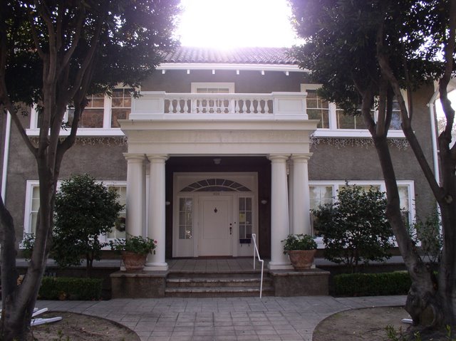
Kearney’s death in 1906 kept the chateau from being constructed. Kearney had been living in a large home on the property that was ultimately intended to be the Superintendent’s Lodge, a home for the ranch manager.
UC
Kearney willed his property to the University of California and the Lodge, now known as the Kearney Mansion, was used by the University until 1962. At that point the Fresno Historical Society began to transform it into a museum.
The home has now been a museum for over 50 years. Several restoration projects during that time period have returned it to its original appearance.
Over 70% of the furnishings and décor are original
The others have been matched from old photographs. Constructed in a French Renaissance style out of local materials, the mansion’s two-foot thick outer walls are actually plaster-covered adobe bricks.

Civil War - PHOTO BY ADAM BLAUERT
Hour-long tours of the Kearney Mansion are offered Friday, Saturday, and Sunday at 1, 2, and 3PM. Tour guides are knowledgeable and you will learn a lot about the history and development of our valley during your visit. While in the “mansion” you can see images of what Kearney’s planned chateau would have looked like.
If you’re interested in learning more you can pick up a copy of M. Theo Kearney: Prince of Fresno in the gift shop. Eventually the Fresno Historical Society plans to create a larger museum at the site to tell the story of the San Joaquin Valley and its people.
Admission to the mansion is $5 for adults, $4 for seniors, students with ID, and youths 13-17, and $3 for children 3-12. Children under 3 are free. Special Christmas tours are offered in December.
For more information
or call (559) 441-0862.

Kearney Park Picnic - PHOTO BY ADAM BLAUERT
An additional $5 is charged by the County of Fresno to enter the park. The park is open during daylight hours. In addition to the mansion, the park offers:
Shaded picnic tables and reservable group picnic shelters
Playgrounds
Soccer fields
Softball diamonds
Horseshoe pits
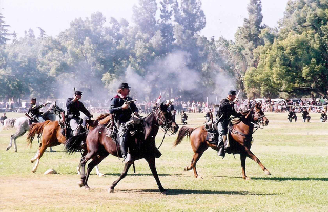
Annual Kearney Park events include
September: Highland Gathering and Gameshttp://www.scottishsociety.org/index.php?option=com_content&view=article&id=52&Itemid=55
October: Civil War Reenactment http://www.valleyhistory.org/index.php?c=19
November: Kearney Park Renaissance Faire http://www.kearneyrenaissancefaire.com/
For more information about Kearney Park, go to http://www2.co.fresno.ca.us/4510/4360/Parks/parksresvinfo.htm
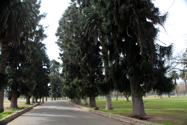
Kearny Park Tree-Lined Boulevard - PHOTO BY ADAM BLAUERT
Location
To get to Kearney Park from Merced County, head south on Highway 99, exiting at Grantland. Follow Grantland south for 7 miles until it ends at Kearney Boulevard.
Turn left and watch for the park entrance on the right. The palm and eucalyptus trees around the park were planted by Kearney. They line Kearney Boulevard all the way into downtown Fresno where Kearney ends at Fresno Street.
Other historic home museums within an hour’s drive of Merced County include
Sources:
Rehart, Schyler and William K. Patterson. M. Theo Kearney: Prince of Fresno. Fresno: Dumont, 1988.
http://www.valleyhistory.org/index.php?c=58
http://historicfresno.org/nrhp/kearney.htm
http://www.scottishsociety.org/index.php?option=com_content&view=article&id=52&Itemid=55

Hensley lake ~ Very close to Merced County with many facilities

PHOTO BY ADAM BLAUERT
Hensley Lake
Less visited than nearby Eastman Lake, Hensley Lake has almost as many facilities and comparable fishing. Hensley Lake was created by a dam on the Fresno River.

Hensley Lake - PHOTO BY ADAM BLAUERT
Location: Roads 603 and 400 in Madera County
Distance from Merced: 42 miles
Distance from Los Banos: 69 miles
Operating Authority: U.S. Army Corps of Engineers
Surface Area of Lake: 1,570 acres

Hensley - PHOTO BY ADAM BLAUERT
Facilities and Activities:
Boat ramp
Chemical/flush restrooms
Drinking fountains
Campgrounds/group campgrounds with BBQ grills/fire rings, shelters, hot showers, electric hookups
Picnic areas with tables, shelters, and BBQ grills
Group picnic areas and shelters
Swimming area
Playground
Dump station
Hiking/biking/equestrian trails
Wildlife viewing area
Horseshoe pits
Dogs allowed? Yes
Horses allowed? Yes, and a large network of equestrian trails are available
Hunting allowed? Yes
Fish species: Bass, bluegill, catfish, crappie, sunfish. Rainbow trout during winter months.
Boat rentals: No

Hensley - PHOTO BY ADAM BLAUERT

Eastman Lake: Formed by a dam on the Chowchilla reservoir, this tends to be more popular than nearby Hensley Lake.

Eastman Lake
Eastman Lake: Formed by a dam on the Chowchilla reservoir, this tends to be more popular than nearby Hensley Lake.
Location: Road 29, Madera County
Distance from Merced: 43 miles
Distance from Los Banos: 70 miles
Operating authority: U.S. Army Corps of Engineers
Surface area of lake: 1,780 acres
Facilities and activities
Boat ramps
Flush restrooms
Drinking fountains
Visitor center
Campgrounds/group campgrounds with BBQ grills/fire rings, shelters, hot showers, RV hookups
Picnic areas with tables, shelters, and BBQ grills
Group picnic areas and shelters
Swimming beach
Playground
Dump station
Hiking/biking/equestrian trails
Wildlife viewing area
Softball diamond
Volleyball courts
Horseshoe pits
Hunting permitted
Dogs allowed? Yes
Horses and hunting
Yes - a large network of equestrian trails and an equestrian campground are available.
Hunting allowed? Yes
Fish species
Bass, bluegill, catfish, crappie. Rainbow trout during winter months.
Boat rentals: No

Reservoirs, Fishing, and Boating within an Hour of Merced County Communities

PHOTO BY ADAM BLAUERT
Hub for boating, fishing, and water recreation
Encircled by the reservoirs of the Central Valley’s irrigation system, Merced County is a hub for boating, fishing, and water recreation. From the foothills of the Sierra Nevada on the eastern side of the county to the Diablo Range on the west side, there are eleven lakes within an hour’s drive of all communities in the county.
Few counties have so many highly-rated areas for boating and fishing.
Running east to west across the county, the Merced River has many access points for fishing. Portions of the San Joaquin, Chowchilla, and Fresno Rivers also flow through the county. The Tuolumne and Stanislaus Rivers lie just outside the county’s borders. While a boat is necessary to access some of the best fishing areas, there are also many lesser-known locations to fish from the shore of a river or lake.
Hot months of summer
Most reservoirs and river access points offer camping, picnicking, swimming, and other recreational activities. Spring and fall usually have the most comfortable weather. Swimming, waterskiing, wakeboarding, and other kinds of water recreation are enjoyed during the hot months of summer.
For more information
Click on any of the reservoirs or river access points listed below for more details on that area. Links to websites maintained by each recreation area are provided for additional information, regulations, campground reservations, and contact information.

eastman lake PHOTO BY ADAM BLAUERT
Reservoirs:
San Luis Reservoir - O’Neill Forebay - Los Banos Creek Reservoir
Adam blauert
All kinds of boat and water recreation are allowed at these reservoirs except at Los Banos Creek Reservoir where a 5 mph speed limit keeps the lake calm for fishing. Please know and adhere to the speed limits posted at other lakes.
River Access in Merced County
The best river fishing in Merced County is along the Merced River. The river was named Rio de Nuestra Senora de Merced by a Spanish expedition in 1806. The current name and the name of the county were derived from this original name.
Running 112 miles from Merced Lake in the high country of Yosemite National Park, the river empties into the San Joaquin River at Hill’s Ferry in the northwestern corner of Merced County. From Merced Lake, the river cascades down Nevada and Vernal Falls, and then through the entire length of Yosemite Valley.
Controlling the snow melt
It is joined by smaller North and South Forks in the steep river canyon between Yosemite Valley and Lake McClure. The river is dammed by New Exchequer Dam at Lake McClure, McSwain Dam at Lake McSwain, a dam at Merced Falls, the Crocker-Huffman Dam between Merced Falls and Snelling, and several smaller dams.The river’s flow depends on the previous year’s snowfall.
Between Snelling and Hill’s Ferry the river is often slow and meandering, but it’s glassy surface can hide a strong current underneath. Exercise extreme caution if venturing into the river. In the upper regions Class IV and III rapids are common and the current can be overwhelming, even in the lower areas.
Safety First
Submerged hazards and deep holes in the channel of the river are not uncommon. Every year unprepared swimmers drown in the river.
don pedro lake
Overall recommendations for best fishing with a boat
O’Neill Forebay and Don Pedro Lake are usually the highest-rated and most consistent fisheries in the area.
Lake McClure, Lake McSwain and Modesto Reservoir also generally provide excellent fishing.
Eastman Lake and Hensley Lake can be good when their water levels are high.
Best boating and water recreation

lake mcclure
O’Neill Forebay
Don Pedro Lake
Lake McClure.
Best river fishing
Bagby Recreation Area at Lake McClure at the MID and PG&E Fishing Access
George J. Hatfield State Recreation Area.
Reservoirs Closest to home
Los Banos: San Luis State Recreation Area
Merced: Lake Yosemite
Other fishing and boating resources
Fishing and Boating Resources at http://www.takemefishing.org/
Department of Fish and Game Regulations: http://www.dfg.ca.gov/
Department of Boating and Waterways Regulations: http://www.dbw.ca.gov/
Reservations for State, Federal, and Army Corps of Engineers Campgrounds:http://www.reserveamerica.com

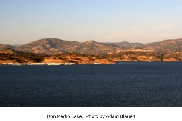
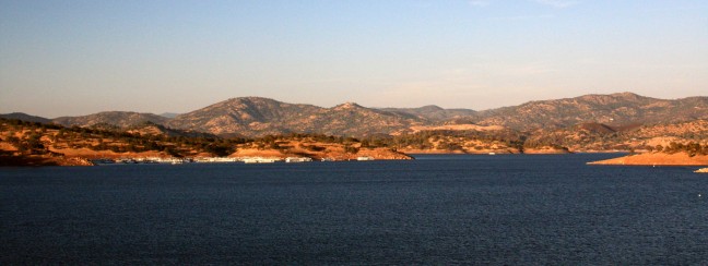
Don Pedro Lake - One of California's highest-rated fishing area & 5th largest artificial lake

PHOTO BY ADAM BLAUERT
Don Pedro Lake
The fifth-largest artificial lake in California, Don Pedro is one of California’s highest-rated fishing areas. This Tuolumne River reservoir is also a prime area for all types of boat-based recreation.
The spectacular 4th of July fireworks show draws huge crowds.
Don Pedro - PHOTO BY ADAM BLAUERT
Location: Bonds Flat Road, Highways 132 and 120
Distance from Merced: 35 miles
Distance from Los Banos: 71 miles
Operating authority: Modesto Irrigation District and Turlock Irrigation District
Surface area of lake: 13,000 acres
Facilities and activities:
Rentals: Boats and personal watercraft including houseboats
For more information
Website: http://donpedrolake.com/index.htm
Special Events
Annual 4th of July fireworks show.

Pacheco State Park
PHOTO BY ADAM BLAUERT
Mexican land grant
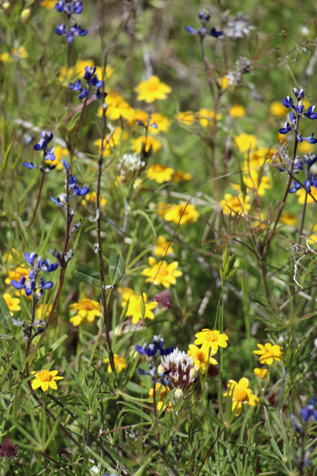
This park preserves part of a large Mexican land grant given to the Pacheco family in 1843. 28 miles of trails are available for hiking, biking, and equestrian use. Thousands of acres of gently rolling oak woodland produces spectacular wildflower displays in the spring. The ruins of the Pacheco Adobe and a well-preserved line shack from Henry Miller’s ranching operation stand near the picnic area.

Photo by akshay
Location
Accessed from Highway 152. Distance from Merced: 59 miles Distance from Los Banos: 23 miles Size: 6,890 acres
Facilities and Activities
Chemical/flush restrooms
An equestrian campground is available for special events; other campgrounds are available at the adjacent San Luis State Recreation Area
Picnic areas with tables
28 miles of hiking/biking/equestrian trails
Wildlife viewing
Wildflower viewing
Dogs Allowed? In picnic area, but not on trails
Horses Allowed? Yes
Hunting Allowed? No
Fishing or Boating? No
Website information
http://www.parks.ca.gov/pages/560/files/PachecoSP_2011.pdf
http://www.parks.ca.gov/?page_id=560
See for a trail guide
http://www.parks.ca.gov/pages/560/files/PachecoTrailMap2006small.pdf

Photo by akshay
Special Events
Ranger-led wildflower hikes in the spring. A kite flying day is also held annually.
Nearby Parks
Camping is available at the adjacent San Luis State Recreation Area

Rainbow Pool – A Great Swimming Hole on the South Fork of the Tuolumne

photo by adam blauert
A cool place to cool off
If you’re looking for a place to cool off in the water, many areas will be more dangerous than usual.
One of the places that you can go for some reliable water recreation on a summer afternoon is the ever-popular Rainbow Pool on the South Fork of the Tuolumne River.
A short waterfall drops into the pool, providing a beautiful backdrop and keeping the water fresh.
The parking area has been repaved, and access has been improved. Restrooms are provided and you can enjoy a picnic lunch between dips in the water.
Rainbow Pool isn’t the kind of place where you are going to find a lot of solitude, but that’s part of what makes it a great place for families. There are generally plenty of people around should any kind of emergency occur.
Your kids are likely to find others to splash and swim with. It’s lose to Highway 120 and easy to find – no wandering around on confusing dirt roads way back in the forest.
How to find the location
To get to this swimming hole, drive 15 miles east of Groveland on Highway 120. Watch for signs on the right side of the road.
Signs for Cherry Lake Road on the left side are another indicator that you are there. Turn right into the day use area and find a parking spot beneath the trees. The swimming hole is just a few steps down the hill.
Traffic is routed through the parking lot in a one-way loop.
Don’t be alarmed when the road takes you under the highway bridge and parallel with the highway on your way out of the lot. It will connect with the highway at the Cherry Lake Road.
Located so close to Yosemite’s Big Oak Flat entrance, it’s a great place to stop on a Yosemite vacation. You can extend your trip by camping at a nearby campground. In fact, one of the best ways to enjoy a multi-day trip to Yosemite is to camp outside the park in one of the nearby campgrounds.
While campgrounds inside the park are booked almost the moment that reservations become available and non-reserved sites are hit-or-miss, campgrounds outside the park boundaries are much better bet.
Campgrounds near Rainbow Pool
You can check current conditions by clicking on each campground above.
Or calling (209) 962-7825.
Watch for brown and white signs with tent icons along Highway 120 to find the campgrounds.
All are operated by the US Forest Service and generally charge less than $25/night.
Diamond O can be reserved in advance through www.recreation.gov, the federal government’s reservation service.
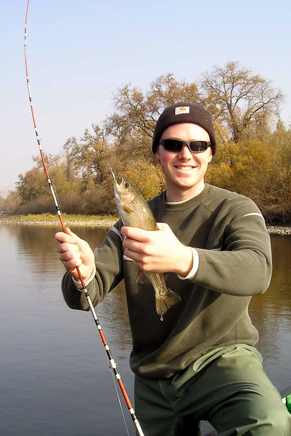
I saw an angler catch a rainbow trout on nearly his first cast into the river above the swimming area. The Department of Fish and Game regularly stocks this part of the river.
Safety First
Now that I’ve gotten you excited about swimming here, remember that all outdoor recreation carries certain risks with it. Swimming is safest in protected pools without strong currents.
Currents may not always be visible to the naked eye, so investigate carefully. Only jump into water if you have carefully ascertained that there is enough depth to do so, and never dive off a rock or cliff. If you are not a strong swimmer, wear a life vest to help you float.
“Water wings” and other flotation devices for children are also strongly recommended, even if they have strong swimming skills.
Most people enjoy swimming in natural pools without any real danger, but every year a few people die from making bad choices.
I write all of these warnings because my goal is to help people make fun memories in the great outdoors and to prevent further tragedies.
The outdoors provides millions of opportunities for recreation, relaxation, physical challenges, and bonding among family members and friends.
Get out and have a great time, just don’t forget safety in the process.
Swimming in developed, popular areas like Rainbow Pool provides an added degree of safety and a bit more peace of mind for Mom!

Tuolumne Meadows – The Other Yosemite

PHOTO BY ADAM BLAUERT
Far fewer visitors
Yosemite Valley is one of the most magnificent places on earth. It can also be one of the busiest during the summer months. The good news is that its beauty is matched by the high elevation meadows, lakes, and peaks that surround it.
These stunning places receive far fewer visitors than the Valley.

Sunset near Tioga Pass - PHOTO BY ADAM BLAUERT
Sunset near Tioga Pass
The most accessible part of this higher region is Tuolumne Meadows. Connected to the rest of the world by the Tioga Road (the section of Highway 120 that crosses the park), it is an easy day trip from any other part of Yosemite or a longer day trip from the Central Valley.
Better yet, it can be enjoyed by overnight camping or backpacking, or by staying in nearby lodging. The more time you spend, the more you can explore.
Tuolumne Meadows has always been of my favorite places in the world. From early to mid summer the sub alpine meadow area turns a lush green and produces brilliant wildflowers. The broad, open meadow is surrounded by pines, granite domes, and striking granite peaks. The Tuolumne River winds its way through the scene.
Visitor Services
During the summer months,Yosemite National Park and its concessionaire operate a large campground, visitor center, and store. Tuolumne Meadows Lodge provides accommodation in rustic tent cabins and meals served in a large tent dining room.
You can get a quick breakfast, lunch, or early dinner at the Tuolumne Meadows Grill. Gas is available, but far more expensive than if you purchase it in the foothills or in the Central Valley.
Campgrounds
Half of the 304 campsites are reservable; the others are available on a first-come, first-serve basis. Because the area is popular, sites are often hard to get.
Group and equestrian camping areas are provided, but must be reserved in advance.
Additional campgrounds operated by the US Forest Service are found to the east of Tuolumne Meadows, just outside the park’s boundaries. Tioga Lake and Ellery Lake Campgrounds are located along Highway 120. Junction, Sawmill, and Saddlebag Lake are on the Saddlebag Lake Road, a short detour off of 120.
Further east along 120, look for signs to additional campgrounds in Lee Vining Canyon. These sites are located midway down the canyon before you reach US 395.
Food is served at Saddlebag Lake Resort (at the end of Saddlebag Lake Road) and at Tioga Pass Resort (just a couple of miles outside the park boundary along Highway 120.
TPR also has cabins for rent.

Olmstead Point View - PHOTO BY ADAM BLAUERT
Olmstead Point View
Places to Stop on the Way to Tuolumne Meadows
As you drive theTioga Road towards Tuolumne Meadows, don’t miss the following stops:
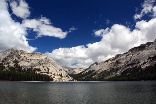
Olmstead Point: An outstanding roadside viewpoint with vistas encompassing Half Dome, Clouds Rest, Tenaya Lake, and many striking granite peaks.
Tenaya Lake: One of the largest natural lakes in the Central Sierra, this 150 acre beauty is surrounded by glacially-sculpted granite peaks and domes.
It’s a great place for a picnic or a chilly swim at the sandy beach at the eastern end.
Tenaya Lake - PHOTO BY ADAM BLAUERT
Tenaya Lake
Adjusting to the Elevation
At about 8,600 feet above sea level, Tuolumne Meadows is nearly twice the elevation of Yosemite Valley.
The air is thinner the higher you go and you will find that you get short of breath faster. Take it easy if you are not used to the elevation and don’t attempt any of the more difficult hikes on your first day in the area.
Your body needs time to adjust to the thinner air. The sun’s rays are more intense at higher elevations, so don’t forget sunscreen, a hat, and sunglasses.
Weather, Clothing, and Safety
The weather can change quickly and afternoon thunderstorms are common in the summer months.
Bring clothing that you can layer and unlayer as necessary. A waterproof poncho is invaluable during a thunderstorm if it hits when you aren’t near your vehicle.
Many of the hikes in the Tuolumne Meadows area take you to high, exposed areas. Avoid these places during thunderstorms!
Be especially cautious around the swift, frigid waters of the Tuolumne River and its tributaries. This year’s exceptional snow melt has made theme more dangerous than usual.
Early Season Cathedral Lakes - PHOTO BY ADAM BLAUERT
Early Season Cathedral Lakes
When to Visit
Summer is the season to visit Tuolumne Meadows. Buried under snow for much of the year, the Tioga Road is only open from the time the snow melts (usually in late May or early June) through the first snowfall (October or early November).
Many visitor services close by the middle of September, though the road may be open for weeks after that.
Maps and Finding Your Way Around
Pick up a free map when you enter the park. The shuttle map is more detailed and will help you locate all of the attractions and services described in this article.
You can download it at: http://www.nps.gov/yose/planyourvisit/loader.cfm?csModule=security/getfile&PageID=222905.
If you plan to hike, get a more detailed map.
The Tuolumne Meadows map produced by Tom Harrison Maps is excellent and can be obtained directly through Tom Harrison’s website: http://www.tomharrisonmaps.com/.
It is also usually available at the stores inYosemite Valley, Tuolumne Meadows, and Crane Flat.
Recommended Hikes in the Tuolumne Meadows Area
Tuolumne Meadows, Parsons Lodge, and Soda Springs: This 1.5 mile loop is a great place to start if you’ve never been to Tuolumne Meadows.
It loops through the heart of the meadow area. Parsons Memorial Lodge is a great place to stop and rest and the volunteers on duty can answer questions about the area.
This hike involves almost zero elevation gain and loss.
Lyell Fork - PHOTO BY ADAM BLAUERT
Lyell Fork
Lyell Fork of the Tuolumne River
This is one of my top 10 favorite hikes inYosemite, and it is one of the easiest. You can hike as many as four miles upLyel lCanyon with only a 200 foot elevation gain. Many people don’t go that far and the beautiful river can be enjoyed by only hiking part of the route and returning when you start to feel tired.
Elizabeth Lake
More challenging, the hike from the campground to Elizabeth Lake is a 4.8 mile round trip. Hikers climb about 1,000 feet to reach the destination.
Lembert Dome
The round trip hike to the top of this prominent dome is only 2.4 miles round trip, but involves a steep 850 foot elevation gain. Unless you are in excellent physical condition, you’ll need to stop and rest from time to time. The views from the top encompass the entire Tuolumne Meadows region and are truly astounding.
Cathedral Lakes
The elevation gain involved in hiking to these two beautiful lakes is about the same as the climb toElizabeth, but is 2.2 miles longer. This is my favorite shorter lake hike in the Tuolumne Meadows area.
Glen Aulin
The trail to this historic tent camp (reservable through an annual lottery system) follows the Tuolumne River downhill 800 feet. Hikers must climb back up on the way out. This is a stunning section of the river with many cascades, but requires more work than the Lyell Fork trail.
Glen Aulin is one of five backcountry tent camps that hikers can stay at if they don’t wish to pack all of their own gear. Tents and meals are provided, but must be reserved in advance through a lottery system due to their extreme popularity.
Gaylor Lakes
Starting at the summit of Tioga Pass, a one-mile climb of 500 feet takes you to a saddle above Gaylor Lakes. This is absolutely stunning country with a grand views all over theYosemite region.
The steep hike is challenging, but rewarding. Depending how many lakes you explore, the round trip hike is at least two miles in length.
Detailed information about the above listed hikes can be found at: http://www.nps.gov/yose/planyourvisit/tmhikes.htm
20 Lakes Basin
Just outside the park, a series of small but very pretty lakes spread out beyond Saddlebag Lake. Saddlebag Lake Resort provides daily water taxi service transporting visitors across the lake to the start of the trail.
Round trip cost is $11/adults, $10/seniors, $6/children 12 and under, $5/dogs. Taking the water taxi saves 3 miles of hiking around the lake. Dogs are welcome on this trail, but not on any of the trails within the park.
Fishing in these lakes can be excellent for small brook trout; larger fish can be found in SaddlebagLake.

20 Lakes Basin- Photo by adam blauert
20 Lakes Basin
For more information on hiking the 20 Lakes Basin, the water taxi service, and renting your own fishing boat at Saddlebag Lake Resort, go to: http://www.saddlebaglakeresort.com/index.html
Tuolumne Meadows is a popular starting place for rock climbing and overnight backpacking trips.
More information about wilderness permits and planning an overnight trip can be found at: http://www.nps.gov/yose/planyourvisit/wildpermits.htm.
Guided backpacking trips can be arranged if you are interested in learning how to backpack: http://www.yosemitepark.com/Activities
HikingCamping_OvernightBackpackingTrips.aspx
Exploring Further East of Tuolumne Meadows
Beyond Tuolumne Meadows, Highway 120 continues to climb to the summit of Tioga Pass at an elevation of 9, 946 feet. Although the park’s boundary ends here, the spectacular scenery does not. Worthy stops include:
Tioga Pass
A small parking area at the summit allows you to enjoy views of some of the park’s highest peaks and summits.
Tioga and Ellery Lakes
These manmade lakes on Lee Vining Creek are scenic and provide excellent fishing.
Saddlebag Lake
At an elevation of 10,087 – higher than any point you can drive to in the park – this large, beautiful lake provides the gateway to alpine regions that are covered with snow much of the year.
The water taxi service provides quick access to the 20 Lakes Basin Trail and the resort serves delicious hot food. Fishing boat rentals are available. Saddlebag Lake Road is unpaved, but passable for all cars if driven carefully.
More information can be found at: http://www.saddlebaglakeresort.com/
With hot meals and cozy cabins, TPR provides the greatest level of comfort and services close to Tioga Pass.
If camping isn’t your thing, this is the place to stay.
Go to http://www.tiogapassresort.com/ for more information.
Horseback Riding
Guided horseback rides are available in Tuolumne Meadows – more information can be found at http://www.yosemitepark.com/activities_mulehorsebackrides.aspx.
Fishing
Fish are no longer stocked in Yosemite National Park.
Natural reproduction is limited and anglers usually have the best luck just outside the park at Tioga, Ellery, and Saddlebag Lakes and among the lakes of the 20 Lakes Basin.
Transportation
You can easily access Tuolumne Meadows in your own car on theTioga Pass Road (Highway 120), however, several options are available if you would prefer not to drive or would like to leave your car in one place once you get there.
A free shuttle bus operated by the National Park Service runs between all of the destinations in Tuolumne Meadows during the summer months from 7AM to 7PM daily (Olmstead Point to Tuolumne Meadows Lodge with ten stops). It also makes stops at the MonoPasstrailhead and the TiogaPassentrance station twice a day
For more information go to: http://www.nps.gov/yose/planyourvisit/tmbus.htm.
YARTS (Yosemite Area Regional Transportation System) provides regular transportation from Yosemite Valley over Highway 120 to Mammoth Lakes with 12 stops along the way. For more information, go to: http://www.yarts.com/schedule
YARTS also provides transportation fromMerced to Yosemite Valley along Highway 140 with stops at Catheys Valley, Mariposa, Midpines, and El Portal.
Yosemite entrance fees are included in the ticket prices.
Tour busses operated by the park’s concessionaire provide transportation between Yosemite Valley, White Wolf, Tuolumne Meadows, and several stops along the Tioga Road.
Call (209) 372-1240 for more information.

Parsons Lodge - photo by adam blauert
Links – For More Information
General National Park Service Information about Tuolumne Meadows
http://www.nps.gov/yose/planyourvisit/campground.htm
TuolumneMeadows Lodge
http://www.yosemitepark.com/accommodations_tuolumnemeadowslodge.aspx
Campground Reservations: http://www.recreation.gov/
Tuolumne Meadows Free Shuttle Bus Information and Map: http://www.nps.gov/yose/planyourvisit/tmbus.htm
http://www.nps.gov/yose/planyourvisit/loader.cfm?csModule=security/getfile&PageID=222905
High Sierra Camps Lottery: http://www.yosemitepark.com/Accomodations_HighSierraCamps.aspx
Tuolumne Meadows – Tioga Pass Hikes.
http://www.nps.gov/yose/planyourvisit/tmhikes.htm
Saddlebag LakeResort– meals and water taxi service to 20 Lakes Basin: http://www.saddlebaglakeresort.com/
Tioga Pass Resort: http://www.tiogapassresort.com/
Guided Horseback Rides: http://www.yosemitepark.com/activities_mulehorsebackrides.aspx
Guided Backpacking Trips.
http://www.yosemitepark.com/Activities_HikingCamping_OvernightBackpackingTrips.aspx
Backpacking and Wilderness Permits:
http://www.nps.gov/yose/planyourvisit/wildpermits.htm
Tom Harrison Maps: http://www.tomharrisonmaps.com/
Road Conditions
Yosemite National Park Daily Traffic Forecast : http://www.nps.gov/yose/planyourvisit/traffic.htm

Modesto Reservoir Regional Park

Modesto Reservoir Regional Park
Popular with residents of Modesto and Turlock, this park is surprisingly close to Merced and offers a lot of recreational opportunities and facilities.
Location
Reservoir Road (accessed from Highway 132) between Waterford and La Grange.
Distance from Merced: 37 miles
Distance from Los Banos: 51 miles
Operating authority: Stanislaus County Parks and Recreation
Surface area of lake: 2,800 acres
Facilities and activities
Boat ramp, marina
Concessions booth
Flush restrooms
Drinking fountains
Campgrounds with BBQ grills/fire rings, RV hookups
Picnic areas with tables, shelters, and BBQ grills
Group picnic areas and shelters
Swimming area
Wildlife viewing area
Archery range
Radio-control airplane flying
Dogs allowed? No
Horses allowed? No
Hunting allowed? Yes
Fish species: Bass, trout
Boat rentals: No
Website: http://www.co.stanislaus.ca.us/er/parks/
Recreation organizations
The Mid-Valley Water Ski Club holds events throughout the year for people of all ages and abilities. http://www.midvalleywaterskiclub.com/ for more information.
The Yahi Bowmen Archery Club operates the reservoir’s archery range. Guests are welcome and regularly-scheduled activities are offered for people of all ages and abilities. https://www.facebook.com/YahiBowmenModesto for more information.

McConnell State Recreation Area

PHOTO BY ADAM BLAUERT
McConnell State Recreation Area
Like the other Merced River Parks, McConnell has a lot of shade. It’s also a bit more developed than Hatfield and further from the highway.
If I were to pick a Merced River park in the Valley to camp at, this would be it.
Location
8800 McConnell Road, Ballico, CA
Distance from Merced: 22 miles
Distance from Los Banos: 35 miles
Size: 74 acres
Facilities and activities
Flush restrooms
Drinking fountainsCampgrounds/group campground with BBQ grills/fire rings, hot showers
Picnic areas with tables and BBQ grills
Group picnic area
Swimming area
Dogs allowed? Yes
Horses allowed? No
Hunting allowed? No
Fishing or boating?
Fishing can be good at McConnell Recreation Area.
Rainbow trout and bass can be caught in the spring; catfish and perch throughout the year.
No boating ramp is provided, but it is possible to swim in the river or to launch a float tube or hand-carried boat.
Website: http://www.parks.ca.gov/?page_id=554
and http://www.parks.ca.gov/pages/554/files/McConnellHatfield.pdf
Nearby parks
Undeveloped Great Valley Grasslands State Park has a six mile hiking trail.

"Only What you can Carry"
“Only What You Can Carry”

bring only what you can carry
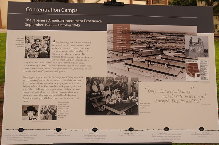
The orders came down in 1942, striking fear into the hearts of Japanese-Americans of Merced County and Northern California. The children were unsure of their futures and their parents secreted the harsh realities from them. The families were told to abandon their homes and bring only what they could carry and report to the Merced Assembly Center at the County Fairgrounds.
By Executive Order 9066, signed on February 19, 1942, Japanese-Americans would be interned against their will. After suffering through the heat of the summer, the families were relocated to Amache, Colorado- some incarcerated for the duration of WWII.
concertration camp
History of Merced Assembly Center Commemorative Committee (MACCC)
In the spring of 2008, Congressman Dennis Cardoza, (D-18th District) requested the Livingston-Merced and Cortez chapters of the Japanese-American Citizens League (JACL) to work on a monument to commemorate the 4,669 Americans of Japanese ancestry detained at the Merced Assembly Center located in the Merced County fairgrounds. The Commemorative Committee and its Advisors with the support and help of many people have worked 2 years on making the Memorial a reality.
Unveiling and Dedication of the Merced Assembly Center Memorial

japanese wall
The Memorial was unveiled and dedicated on February 20th, 2010. The event was a huge success thanks to the support of many individuals, the Merced County Fair Board, Merced Country Supervisors, Civic Groups, and the Community. Around 1,500 people attended the Dedication and 875 people attended the Dinner.The Committee continues seeking grants and donations to help finance this $300,000 project. Future endeavors will involve educating the public about the significance of this incarceration in America’s history.
Come visit the Merced Assembly Center Memorial
Merced County Fairgrounds, 900 Martin Luther King Jr. Way, Merced, CA 95341.

assembly center
For more information about the Memorial or information on guided classroom or group field trips
Merced Assembly Center is on facebook (click here)
please contact: Bob Taniguchi (209) 631-5645 Taniguchi.r@mccd.edu
or Patti Kishi (209) 769-7543 pkishi@vtlnet.com

The Merced County Library

library
Merced County Library
Amy Taylor, County Librarian
2100 O Street Merced
For more information call:(209) 385-7478
See our website at: - - - -www.mercedcountylibrary.org
The Merced County Public Library, rural and small, seeks to be an integral part of its community by providing all residents with a balanced range of resources and activities, meeting educational, cultural, and recreational needs.
The Library serves as the center for lifetime learning and enjoyment.
A knowledgeable Library staff provides high-quality reader's guidance and research and assistance using local resources and interlibrary materials and services.
The friendly environment of the facility promotes maximum resource utilization.
Serving you with over three million...Books, DVDs, audio books, downloadable books, music CDs, software and video games available!
Three million items
Valley Cat is the online catalog used by all the libraries which are members of the San Joaquin Valley Library System.
Valley Libraries
These libraries include Merced County Library, Fresno County Library, Coalinga Huron Library District, Kings County Library, Kern County Library, Madera County Library, Mariposa County Library, Porterville Public Library and Tulare County Library.
When you have a library card at one the San Joaquin Valley libraries, you are entitled to borrow materials from any of the libraries in the San Joaquin Valley Library System, or SJVLS. Merced County Library card holders may check out up to 25 items on their cards and request up to 30 items from the libraries in the SJVLS.
This means access to over 3 million total items.

valley cat front page
The Valley Cat online catalog
Borrowers may access their library card accounts from Valley Cat and see the titles and number of items checked out, view the status of their requests, see if they owe any fines and renew their items, using their library card numbers, which are found on the front of their cards.
Each borrower also has a four digit personal identification number, or PIN which is needed to access an account. Borrowers are encouraged to select a PIN that is easy to remember.
The same PIN may be used by all members of a household if desired. The PIN is chosen by the borrower at the time of creating the account. PINS may not be changed online.
Order from your home...online
The Valley Cat online catalog can be accessed from your own computer by going to http://www.mercedcountylibrary.org and then scrolling down and clicking on Online Catalog.
You may search Valley Cat without logging into your account, but if you log in, you are ready to automatically request items and create a list of titles for future reference, sort of like a wish list.
Books, DVDs, audio books, downloadable books, music CDs, playaways, software and video games are available through Valley Cat.
Seven databases
There are seven databases available for use as well as a newspaper index through Valley Cat. The databases are: Ancestry, Chilton’s, Infotrac, Learning Express, Newsbank and Reference USA. If you are accessing these databases from home, you will be asked to log in with your library card and PIN number.

library-spot
Sometimes a borrower searches Valley Cat from home and finds what seems to be the perfect item needed for his or her project, sees that it is checked in, writes down the title, call number or letters and rushes to the library to pick it up, only to discover that it does not belong to a Merced County library, but perhaps to a library in Fresno County.
There is a way to isolate your search so that you only find items in Valley Cat that belong to a certain library. Once you are on Valley Cat’s site, click on Search, then Keywords with Limits.
Enter your search term, then select your choice of location in the box below.
More questions? Please contact the library at 209-385-7643. We are here to help!
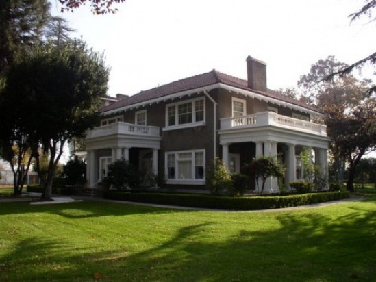
The Atwater Historical Society was formed in 1972 in response to the challenge of keeping the Bloss Home for the community.
Bloss Home
The Atwater Historical Society was formed in 1972 in response to the challenge of keeping the Bloss Home for the community.
The house was willed to the City of Atwater by George Bloss, Jr. with the provision that his wife Christine reside in the home until her death. When this occured in December of 1971 the city was at a loss as to what to do with this property.
Several older citizens of Atwater banned together to form the society and go to bat (so to speak) with the city to make sure the house was not sold or razed.
OLYMPUS DIGITAL CAMERA
The society incorporated in December of 1972 and the specific purposes of the corporation are to collect, maintain, protect, preserve, and research items of historical significance to the City of Atwater and the surrounding area.
The main Purpose
The main focus for many years by the membership has been to restore the house and keep the historical records maintained. The restoration should be complete in another two to three years.
The society also hopes to be able to landmark other historic buildings and homes in Atwater. We have an active and lively membership who help with docent tours of the museum on the first and third Sunday of each month as well as being involved with the community.
We welcome all who wish to join us in these efforts as new perspectives and fresh ideas are always important.
Information on becoming a member is available by either calling the museum at:
357-6309 (please leave a message) or e-mailing us at blosshome@gmail.com.
Adam Blauert, a high school teacher and avid outdoors enthusiast, has dedicated the majority of his life to Merced County. His passions include fishing, backpacking, delving into local history, and exploring the wonders of the western states.